

A storm or two could fire up in the afternoon, but most towns will stay dry. Thunderstorms will become widespread Saturday afternoon as a cold front approaches with some strong to severe. Saturday will be the final day in the 90s with high humidity before relief arrives Sunday.
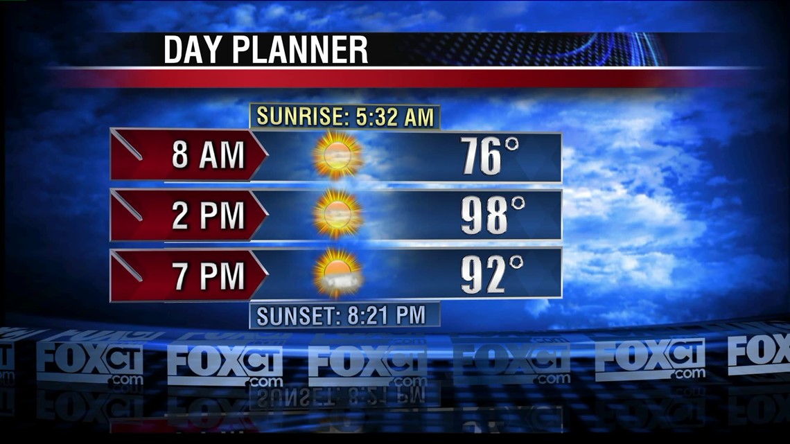
Friday: Mostly sunny, very hot and oppressively humid. Chance for a storm or two during the afternoon. Most stay dry. Heat index 105 or greater. High: Mid to upper 90s
Saturday: Partly cloudy, hot and oppressively humid. Scattered thunderstorms starting midday. Any storm that develops could be strong to severe. High: Upper 80s to low 90s
Sunday: Relief at last. Mostly sunny, noticeably less humid and cooler than recent days. High: Low to mid 80s.
Monday: Partly cloudy, comfortable. Refreshing at night with a low temperature near 60 degrees. High: Low to mid 80s.
Tuesday: Increasing clouds, showers developing. Rain may be heavy at times. High: Low to mid 80s.