
Enjoy today as our quiet weather is about to come to an end as we transition to a very stormy pattern for Christmas week.
High pressure will hang on for one more day today with a mix of sun & clouds and seasonably chilly temperatures. The high will move off the Maine coast that will induce a Northeast flow and thus a few snow showers will move in off the Atlantic Ocean and overspread the area tonight into tomorrow morning. High pressure builds across Ct Monday then drifts off-shore on Tuesday and Wednesday allowing for a southerly flow to develop ahead of the next storm which is a key element in the Christmas Eve and Christmas day forecast. Energy coming out of the Pacific Ocean will merge with moisture from Gulf of Mexico and develop into a major winter storm for the mid-west and Great Lakes. However, this set-up will be a big rainstorm on Christmas Eve for our area as the storm tracks west of Ct. The combination of the high off the mid-Atlantic and the storm riding up the Ohio Valley into upstate New York will create a southerly flow, transporting milder air into the region ahead of the storm thus the precipitation will be rain and not snow.
Forecast Details:
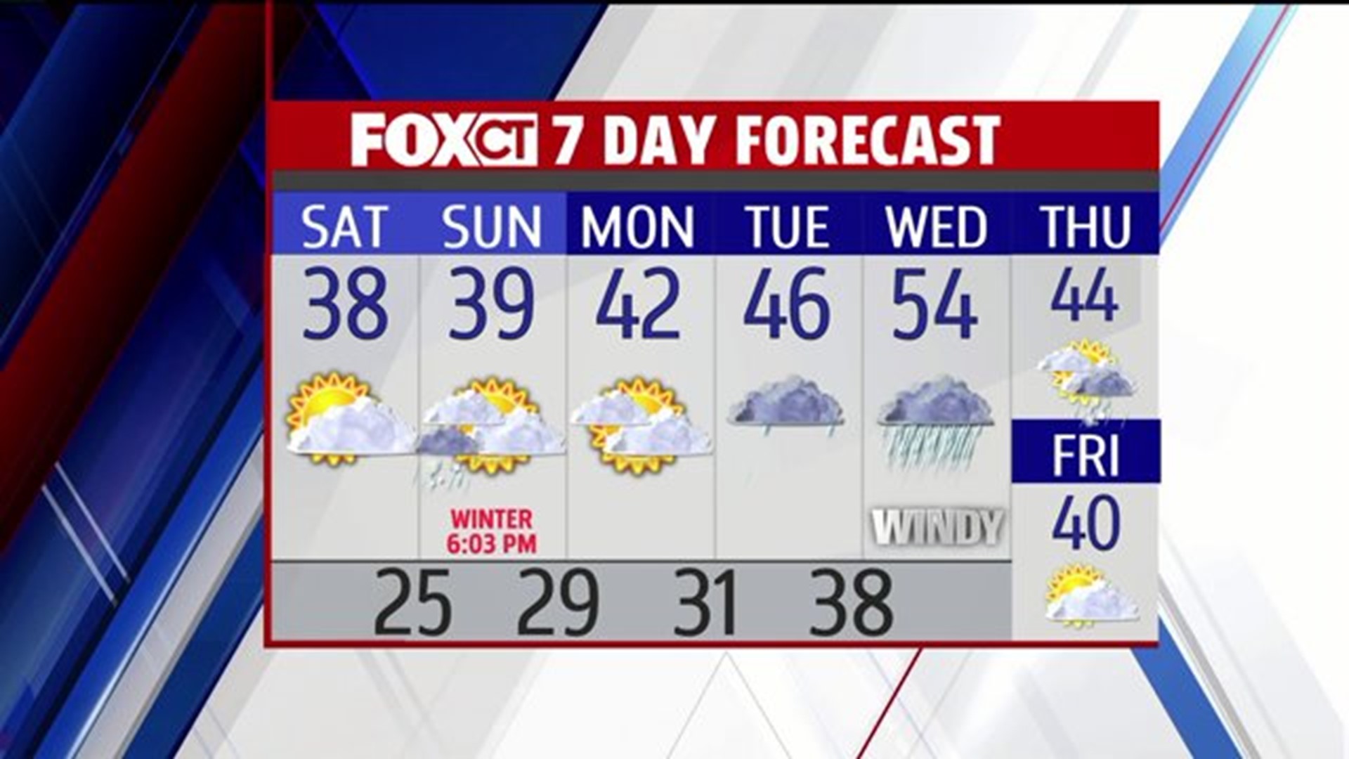
Today: Sunshine mixing with afternoon clouds. High: 30’s.
Tonight: Increasing clouds, chance for a few snow showers after midnight. Low: 20’s.
Sunday: Light snow/rain showers. High: 30’s.
Monday: Increasing clouds. High: 35-40.
Tuesday: Chance for light snow/mix to rain showers. High: 40’s.
Wednesday: Heavy rain and wind, mild. High: 50’s.
Christmas: Partly sunny, windy and turning cooler. Temps falling through the 40’s.
Friday: Partly sunny. High: 40.