We’ve seen some strange weather over the past year. Last February was the coldest month on record and this winter is shaping up to be one of the warmest. We also saw the temperature jump 60+ degrees within a 36 hour period earlier this month, from sub-zero to 60 degrees!
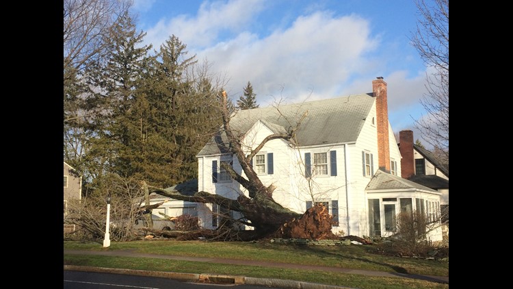
Last night’s storm only added to the mystery of Mother Nature’s recent moods.
First off, this was one of the earliest severe thunderstorm watches issued in the year in recorded history. There has never been another February watch, though there are two on record that occurred in January.
The strongest gust made it up to 75 mph in south Glastonbury! In Hartford, the capital city saw gusts up to 68 mph. At the height of the storm 89,000 were without power, according to Eversource. By 10 p.m. Wednesday night, more than 15 hours after the storm finished, 15,000 were still waiting for the lights to be turned back on.
Another shocking part of the storm was the temperature jump. Between 9 and 10 p.m. the temperature in Hartford soared from 40 degrees to 62 degrees, a 22-degree difference. The quick change is partially attributable to the gusty winds, which pushed the warm front through the state quickly.
This storm was one of the more powerful ones in recent memory, even compared those in the summer when thunderstorms are expected. The governor even declared a limited state of emergency to speed up the repairs and power restoration.
So far, we are tied for the warmest winter on record in Hartford, with an average temperature of 34.9 degrees–that includes nightly lows and daytime highs. There are still a few days left, so it’s not certain that we’ll win the top spot, but it is expected to be warm the next several days.


