
As of 11:28am, we officially say hello to Winter, with the solstice – and yet, we don’t need to wait – it already feels like Winter is in place. It’s cold and sunny today, with light winds that will all combine to keep the temps in the mid to upper 30s today.
We’re watching a storm in two parts moving in overnight – a system tracking from the Rockies will arrive quickly, picking up moisture from the South along the way. What does it mean for us? Trouble.
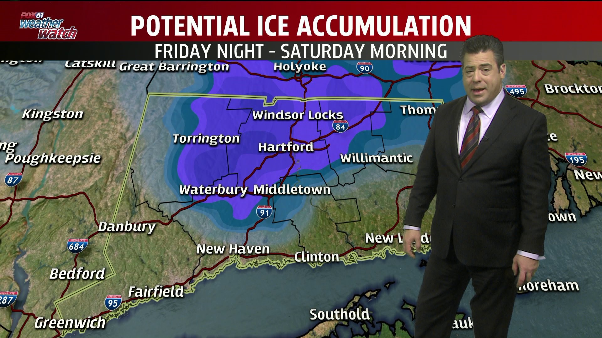
A little snow, mainly on the northern border, arrives overnight. With moderating temperatures across the state, expect a changeover to some icy mix, again primarily for the northern counties, before rain takes over across the state. At the shore ,temps will be a bit milder, with temps reaching the 40s – so problems will be limited.
The rain continues into Saturday, with another shot of plunging temps behind it. That leads, again, to the potential for a wintry mix Sunday night and into Monday, which means Christmas Eve and Christmas may not be white, may not be wet, but possibly…..both.
Forecast Details:
TODAY: Mostly Sunny. Highs : Low 30s inland, Mid to upper 30s, shore
TONIGHT: Increasing clouds , Lows : 20s
FRIDAY: Snow to the north, with some freezing rain inland, All rain at the shore. Highs: Mid 30s inland, Mid 40s shore
SATURDAY: Rain. Highs: Upper 40s
CHRISTMAS EVE: Partly Sunny, cloudy at night with snow/mix/rain potential. Highs near 40
Check out the FOX61 Meteorologists on Facebook:
Dan Amarante, Rachel Frank, Matt Scott, Sam Sampieri, Tim Lavigne
Or on Twitter:
Dan Amarante, Rachel Frank, Matt Scott, Sam Sampieri, Tim Lavigne