
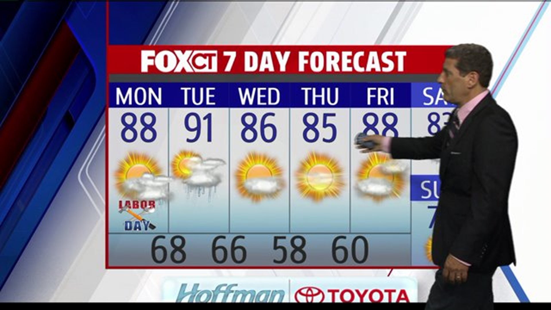
Today and tomorrow will feel like the 4th of July, as mid-summer heat and humidity has moved into Connecticut and all the New England.
Expect a mix of hazy sun and clouds, with temperatures averaging in the upper 80’s today and possibly 90 or above tomorrow. A cold front will cross the northeast Tuesday night that will usher in a dry, but warm air- mass Wednesday and continue throughout the rest of week.
Expect temperatures to average 5 to 10 degrees above normal for the first full week in September with lots of sunshine. Don’t put the beachwear away yet!
Forecast Details:
Labor Day: A mix of hazy sun and clouds, chance for a few scattered thunderstorms late this afternoon into the evening hours: High: mid-upper 80’s.
Tuesday: Mostly sunny, hot and humid, chance for a late day thunderstorm. High: 85-90.
Wednesday: Partly sunny, warm less humid. High: 80’s.
Thursday: Mostly sunny, warm and pleasant. High: 80’s.
Friday: Sunny and hot. High: 90.