
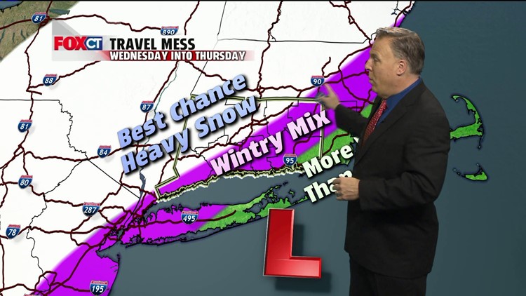
Our quick shot of moderate to heavy rain will end quickly by lunch. Since the storm track is to our west, much warmer air will move into the northeast today. In fact, temperatures will reach the low to mid 60’s this afternoon with partially clearing skies. A gradual cool down will occur tomorrow followed by colder air just in time for a coastal storm that will move up the coast Wednesday afternoon through Thanksgiving morning. Latest information shows that the storm will track toward Cape Cod by early Thanksgiving that will deliver a band of moderate to heavy wet snow across inland Connecticut. If the storm should track closer to the coast then we would get more rain. If the storm tracks further off-shore than more snow would fall across the area. Winter storm watches are posted for inland Ct from early Wednesday through Thursday morning. Stay tuned to FOXCT weather team as we will be tracking this potential winter storm; and how it will affect your travel plans and your Thanksgiving forecast during the few next few days.
Forecast Details
Today: Rain this morning, mostly cloudy this afternoon, windy and warm. High: 60-65.
Tonight: Partial clearing, cooler. Low: 40’s
Tuesday: Mostly sunny, breezy and still mild. High: 50’s
Wednesday: Rain and mixed precipitation developing mid-late morning, becoming heavy wet snow during the afternoon and continuing through Wednesday night. High: 30’s. Low: 25-30.
Thanksgiving: Snow ends early, otherwise partly sunny, brisk and chilly. High: 35-40
Friday: Partly sunny, brisk and chilly. High: 30’s.