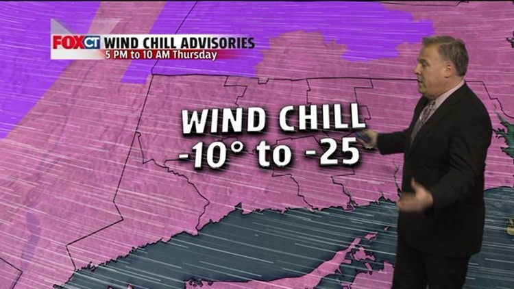
An Arctic cold front will plunge southward midday with a band of snow-showers that could quickly coat the ground with light fluffy blanket of snow across parts of Connecticut. Once the front moves off-shore this afternoon, expect brutally cold air tonight into Thursday. A Wind Chill Advisory is in effect from 5 PM tonight through 10 AM tomorrow morning for wind chill values to drop between -10 to -25 below zero overnight. The wind-chill is what it feels like on your skin when you factor in the gusty winds and very cold temperatures. Low temperatures by Thursday morning will range between -8 to +3 degrees with highs struggling to reach the teens. A cold front will deliver another round light snow Friday that could deliver an inch or two of snow as another reinforcing shot of cold air moves in this weekend. The good news is that the brutally cold air tonight and tomorrow will moderate somewhat by this weekend with highs in the 20’s, lows in the single digits and teens.
Advisories/Warnings
Wind Chill Advisory from 5 PM this afternoon until 10 AM tomorrow morning, for Wind Chill Values to drop between -10 to -25 below zero.
Forecast Details:
Today: Partly sunny, chance for a few passing snow showers. High: 18-23. Wind: NW 15-35 mph
Tonight: Clear, brisk and brutally cold. Low: -8 to +2.
Thursday: Mostly sunny, bitterly cold. High: 15-20.
Friday: Chance for a period of light snow. High: 30.
Saturday: Mostly sunny, chilly. High: 20-25.
Sunday: Mostly sunny. High: 30.
Monday: Sun & clouds. High: 32