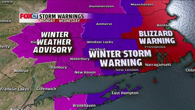
HARTFORD - Depending on where you are in the state, you had a very different experience with this storm. While western Connecticut is barely topping 6 inches of snow, the eastern side of the state saw strong winds and heavy snow for much of the day. Totals are topping one to two feet east of I-91, but in western Connecticut a general 4 to 8 will likely be measured when all is said and done.
So what happened? Storms like this tend to have a tight gradient in regard to snow totals. Accumulations could quickly change town by town. It all depends on where the heaviest band of snow sets up, and in this case, the heavy band just sat over eastern CT for several hours.
There may be a few lingering snow showers into the evening hours, but by Wednesday morning we’ll see big improvements. We then have some sunshine for the day Wednesday, and temperatures will stay cold over the next few days.
Our next chance for snow is a small amount expected early Friday. It'll be a clipper system that may give us a couple inches. This one will NOT be another 20-inch snowfall.
Tonight: Partly cloudy. A lingering snow shower in eastern CT. Chilly and breezy. Lows: Teens.
Wednesday: Some sunshine, but staying cold. Temperatures in the 20s
Thursday: Partly sunny. Temperatures near 30.
Friday: Light snow, with accumulations around 2-5 inches. Temperatures in the 20s.
Saturday: Sunny and cold. Temperatures in the teens.