
Enjoy one more quiet day today with sunshine slowly giving way to some clouds late this afternoon. Temps top out in the upper 20s. We’ve been watching a clipper approach for Thursday, and we had worries that it would potentially bring a lot of snow, but now the thinking is less snow, good for a coating to a couple of inches across the state, with the most towards the East. One thing you can bank on: frigid air returning for Friday, and hanging here at least through the weekend, with highs struggling to get to the teens. There is also the chance for more snow by Saturday night into Sunday as yet another clipper will be re-developing off-shore and throwing back snow over all of New England. Keep the shovels, snow blowers and plows tuned up as there is the potential for more accumulating snow.
Today: Mostly sunny, high 25-30.
Tonight: Increasing clouds. Low: 5-15
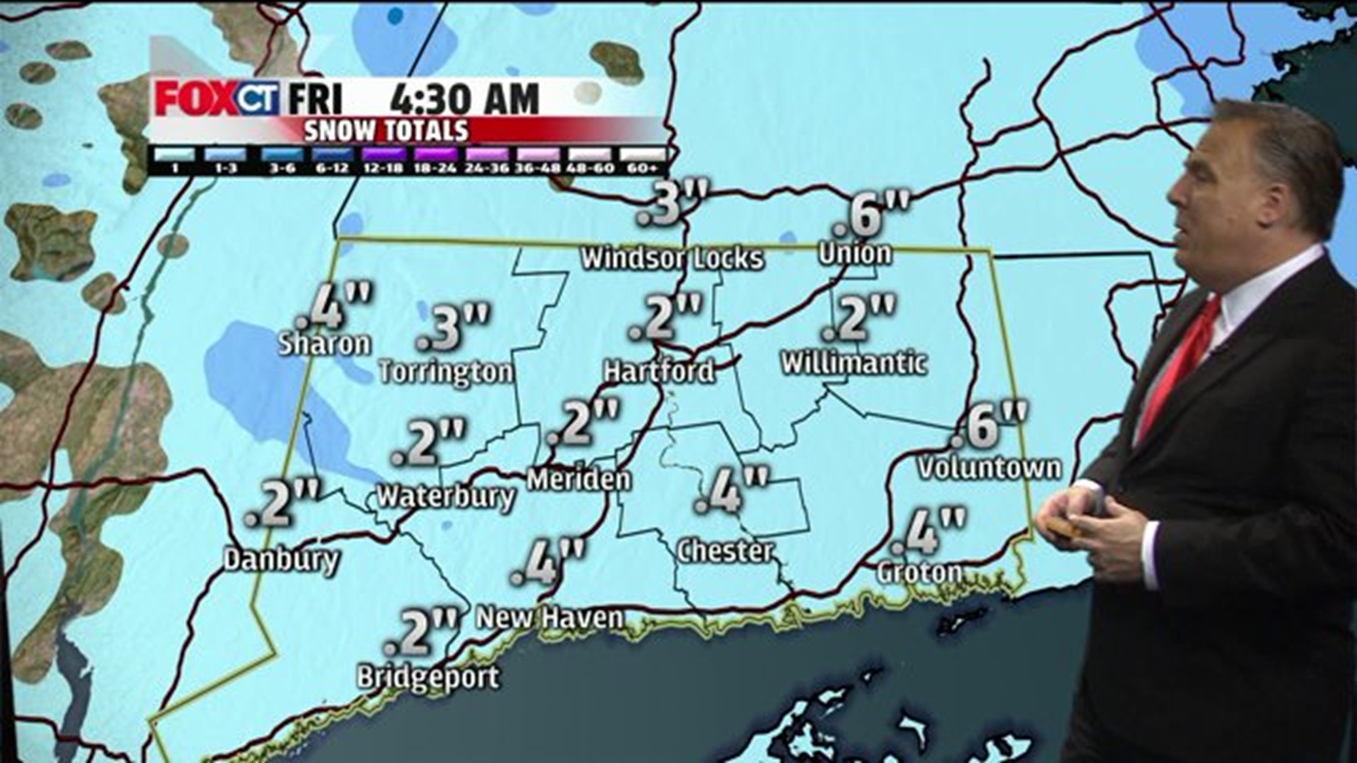
Thursday: More snow is expected, developing during the mid-day and afternoon hours. Periods of light snow Thursday night. High: 20s; low: 20.
Friday: Snow ending early in the morning, then gradually clearing, becoming blustery and bitterly cold. High: teens.
Saturday: Increasing clouds with the snow developing late in the day. High: 10-15.
Sunday: Windy with snow in the morning, clearing in the afternoon. Highs: teens.
Monday: Record lows possible early morning with temperatures well below zero; otherwise, mostly sunny, extremely cold. High: 5-10 above zero.
Tuesday: Sun mixing with high clouds during the afternoon. High: 20’s.