
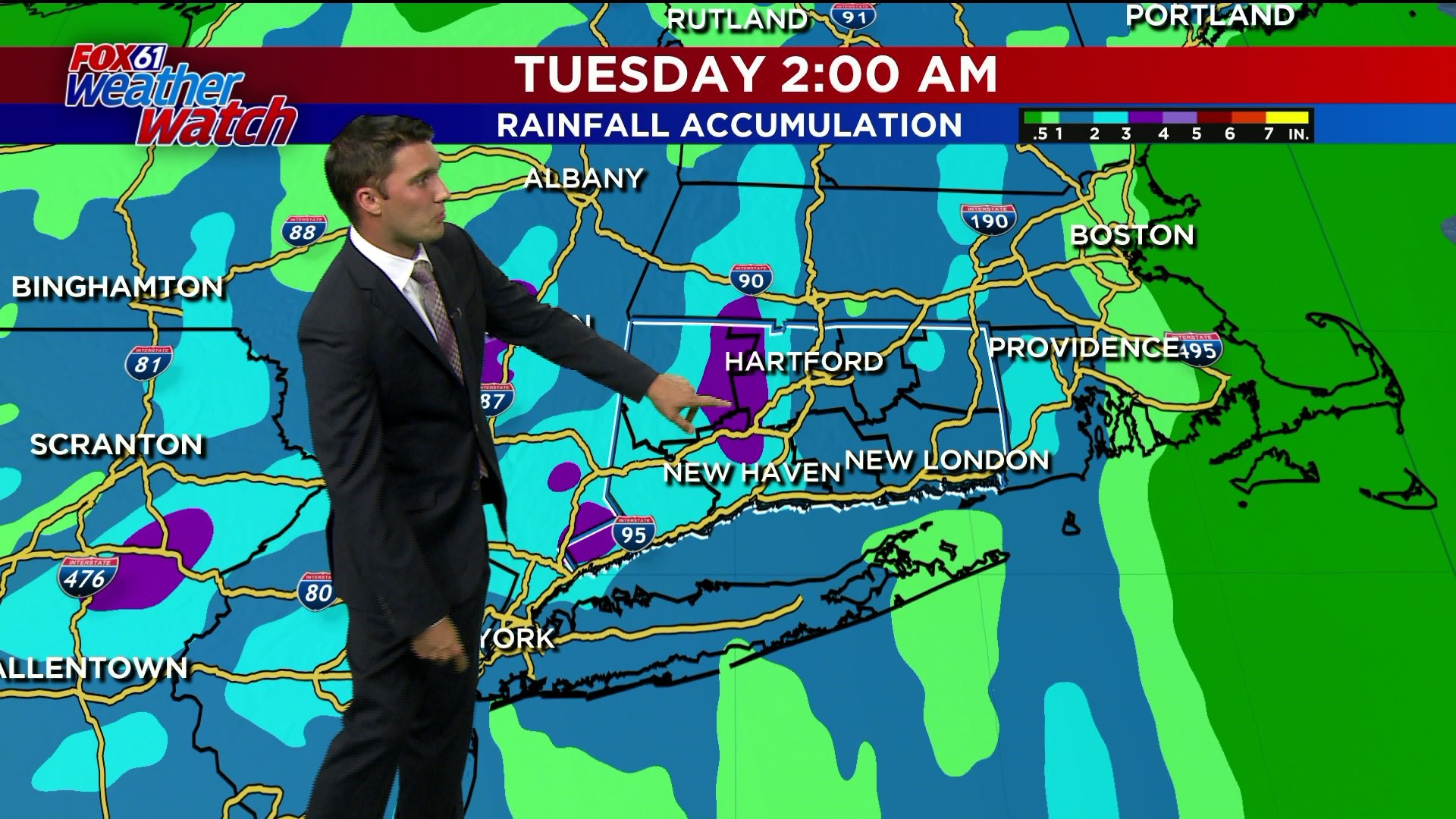
Get ready for the rain, because its coming all week next week. A real gullywasher of a storm is expected through the night tonight with up to 3 inches of rain expected in spots. This tropical moisture will stick around and created scattered showers and storms all week, as multiple storm systems affect us. All told, the potential for widespread areas of 2"+ are expected across the state with isolated amounts of 4"+ possible.
Tonight, some severe weather potential could be realized with storms moving along an advancing warm front. As storms interact with this boundary, these storms could strengthen a bit more than the atmosphere would typically allow at night. Rounds of thunderstorms will also be possible Monday night without the potential for severe weather.
Heading into late week another day of widespread rain will likely come on Thursday. Saturday will also feature the potential for some stronger storms as well. That scenario, is still 7 days out, so take it with a grain of salt for now.
FORECAST DETAILS:
TONIGHT: Mainly clear. Lows: 60s inland, around 60 shore.
SATURDAY: Sunny to partly cloudy. High: Low 80s.
SUNDAY: Showers and thunderstorms likely, humid. (mainly AM??) High: Near 80.
MONDAY: Showers and thunderstorms. High: Mid 80s.
TUESDAY: Mainly dry but still unsettled with the chance for a few showers. High: Near 80.
WEDNESDAY: Continued very humid with the chance for a few showers. High: Low 80s.
Follow our weather team on Facebook!
Dan Amarante, Rachel Frank, Matt Scott, Sam Sampieri, Tim Lavigne, Rachel Piscitelli
Or on Twitter:
Dan Amarante, Rachel Frank, Matt Scott, Sam Sampieri, Tim Lavigne, Rachel Piscitelli