
After a severe storm rolled through southern CT today, we have seen a lot of sun break out. Usually that would be a sign of rising instability and potential for more storms – but with the passage of a warm front, it seems our opportunity is passing us by. No problems there, right?
There is still a chance for a storm or two, but severe weather chances are falling. These showers and storms will end in the evening tonight.
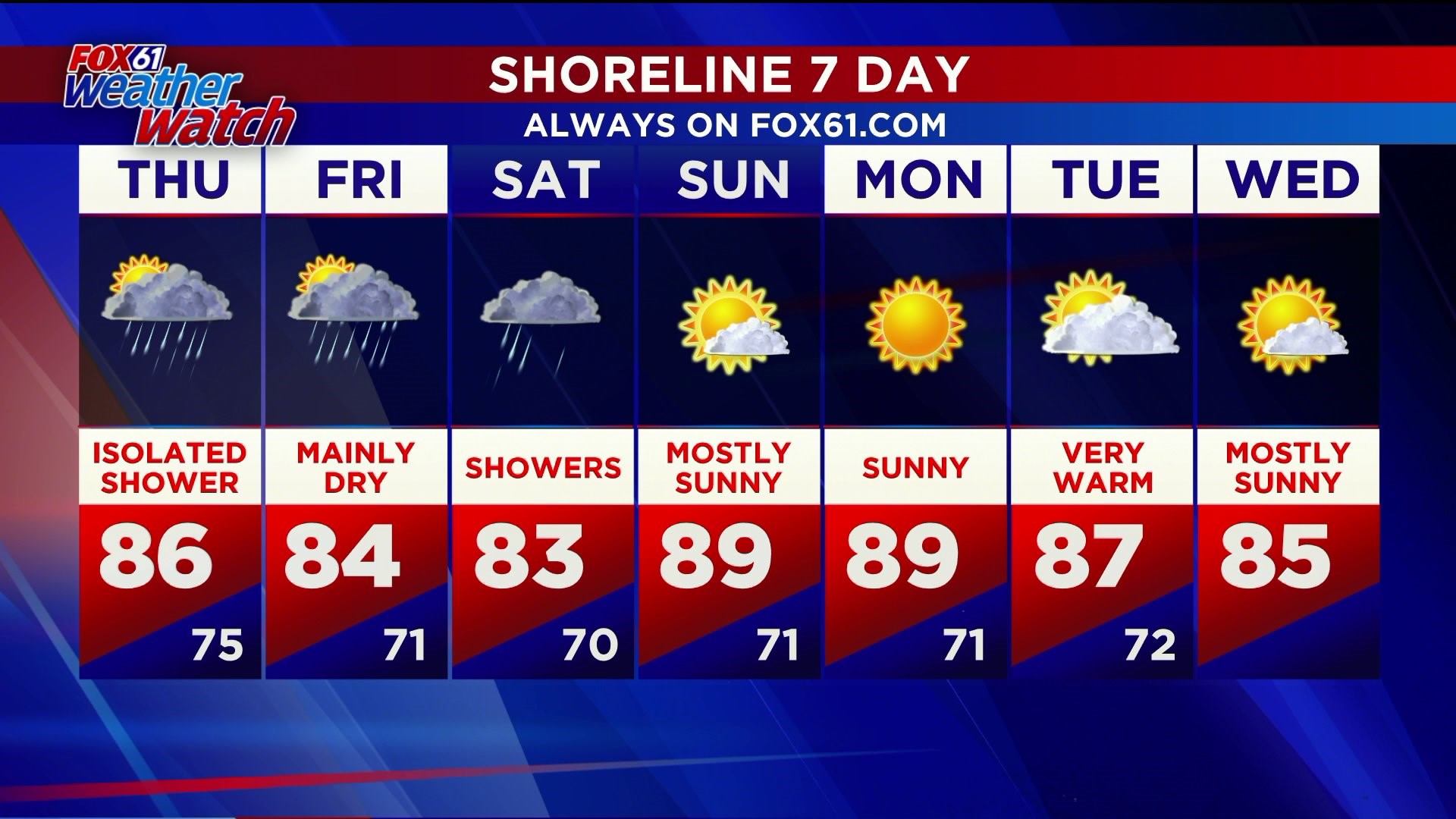
Thursday, Friday and Saturday…think Florida weather! Thursday could feature a strong storm or two, but after that, we will be warm and humid with the chance for a pop up shower or storm in the afternoons (mainly). While storms will be hit or miss, anything that develops could bring torrential rain.
The humidity and unsettled weather pattern should break by Sunday. But summer heat will take its place with temperatures near 90 Sunday and Monday of next week, and it seems we will be setting up for another heat wave.
FORECAST DETAILS:
TONIGHT: Lingering showers at times. Staying mild and muggy. Lows: Mid 70s.
THURSDAY: Partly sunny, hot and very humid. Chance for an isolated afternoon shower or storm. Highs: Mid-upper 80s.
FRIDAY: Partly sunny, very humid, chance of showers and thunderstorms. High: Mid 80s.
SATURDAY: Cloudy, showers, very humid. High: Low-mid 80s.
SUNDAY: Clearing, hot, turning less humid. High: Near 90.
Follow our weather team on Facebook!
Dan Amarante, Rachel Frank, Matt Scott, Sam Sampieri, Tim Lavigne, Rachel Piscitelli
Or on Twitter:
Dan Amarante, Rachel Frank, Matt Scott, Sam Sampieri, Tim Lavigne, Rachel Piscitelli