
There was a nice thaw out there Thursday afternoon after an icy start to the day. Temperatures hit 50 degrees in many towns. We get a brief break from stormy weather over the next couple of days.
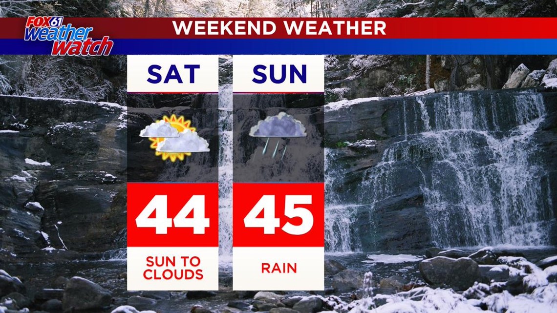
Temperatures will be a bit cooler on Friday with highs in the low 40s. Saturday will be the pick of the weekend/dry before rain moves in Sunday.
As that rain moves in late Saturday night, a brief period of icing is possible for northern CT. (We can't go 3 days this winter without using the words "wintry mix!") This one doesn't look like a big deal though. By Sunday morning it's all rain across the state. Rain will come down heavy at times throughout the day.

Then, hold onto your hats! Strong winds will develop on Monday as that storm pulls away. Wind gusts could top 50+ mph in spots.
The next chance for a bit of snow is Wednesday of next week with the chance for an Alberta Clipper type storm.
Forecast Details:
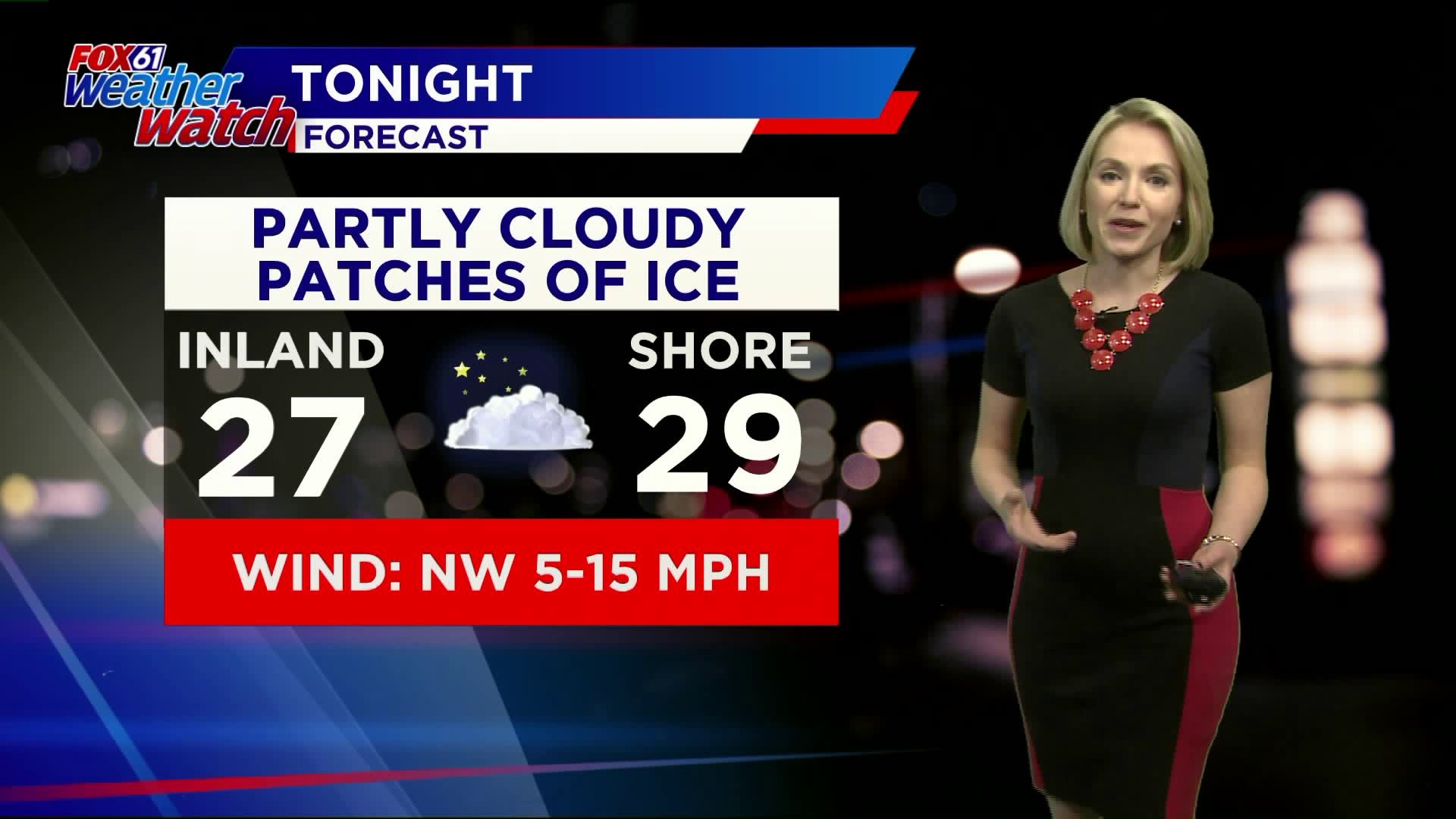
TONIGHT: Partly cloudy. A few icy spots as puddles re-freeze. Lows: 20s.
FRIDAY: Mostly sunny. High: low 40s.
SATURDAY: Increasing clouds. High: low 40s.
SUNDAY: Rain. High: Mid-upper 40s inland, near 50 shoreline.
MONDAY: Very windy, cooler. High: 30s.
TUESDAY: Partly cloudy. High: low 30s
WEDNESDAY: Chance snow. High: Low 30s
Follow our weather team on Facebook!