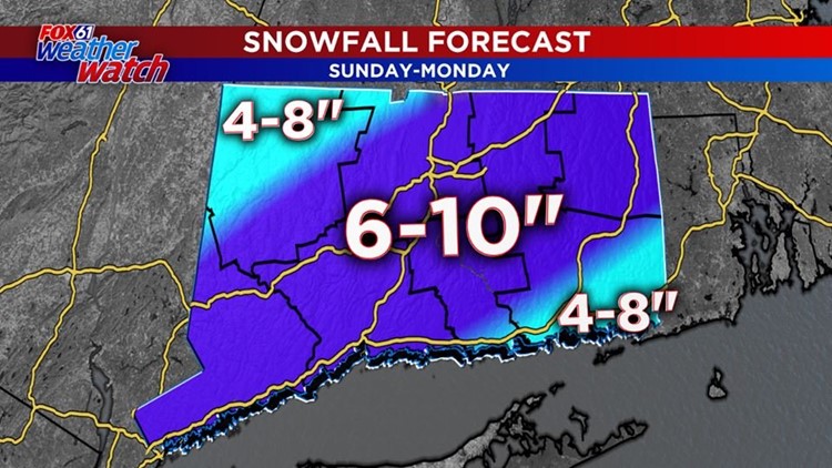
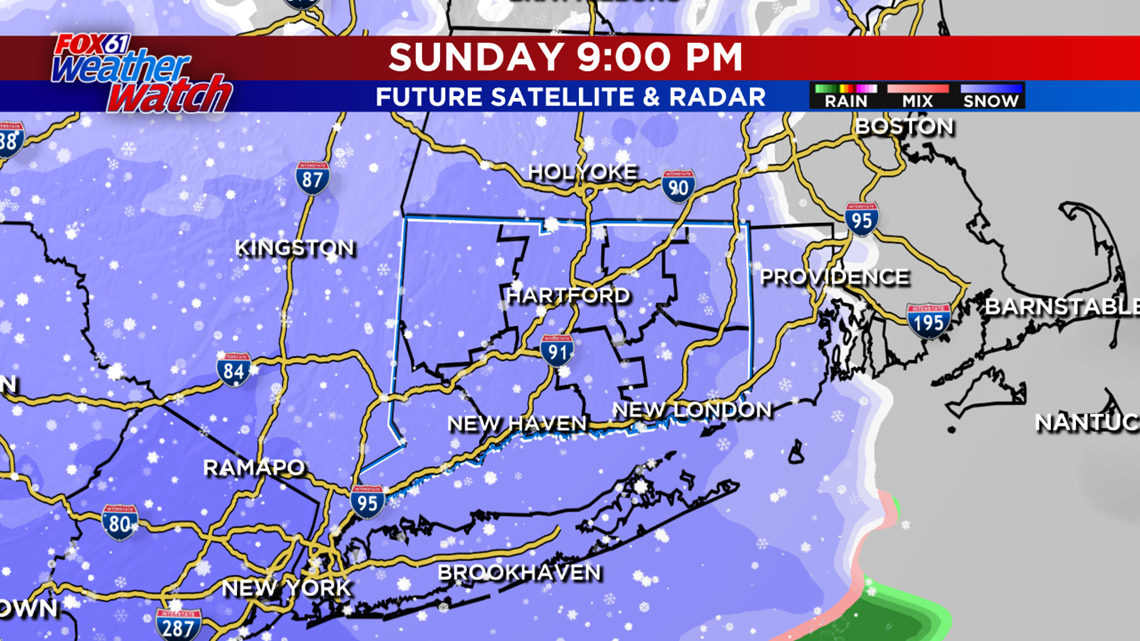
TIMING/PRECIPITATION TYPE: Snow will develop tonight and will persist in light to moderate intensity until after Midnight. Stronger snowfall is expected from around 1-4am, with deformation banding occurring. It is in this area – where we will see the greatest potential for 1″/hr snowfall rates. This storm will not tap into a deep pool of moisture, so this won’t be a blockbuster, but it’s surely enough for a significant winter storm – the most significant we have had this winter in most spots.
For a full list of closings and delays, click here.
FORECAST DETAILS:
TONIGHT: Heavy snow may change to a wintry mix/rain south and east of I-84. Low: Mid 20s.
MONDAY: Snow/mix gradually tapers off through the morning. Some clearing in the afternoon, milder too. High: Near 40.
TUESDAY: Partly cloudy. High: Low 30s.
WEDNESDAY: Partly cloudy. High: Near 30.
Follow our weather team on Facebook!
Dan Amarante, Rachel Frank, Matt Scott, Sam Sampieri, Tim Lavigne, Rachel Piscitelli
or on Twitter:
Dan Amarante, Rachel Frank, Matt Scott, Sam Sampieri, Tim Lavigne, Rachel Piscitelli