CONNECTICUT, USA — With this high-impact rain event, timing is everything. Luckily for us, the heaviest of the rain will occur after dark, so hopefully, most cars will be off the roads by the time the flash flooding risk is highest.
Here is the projected timeline in 4-hour increments:
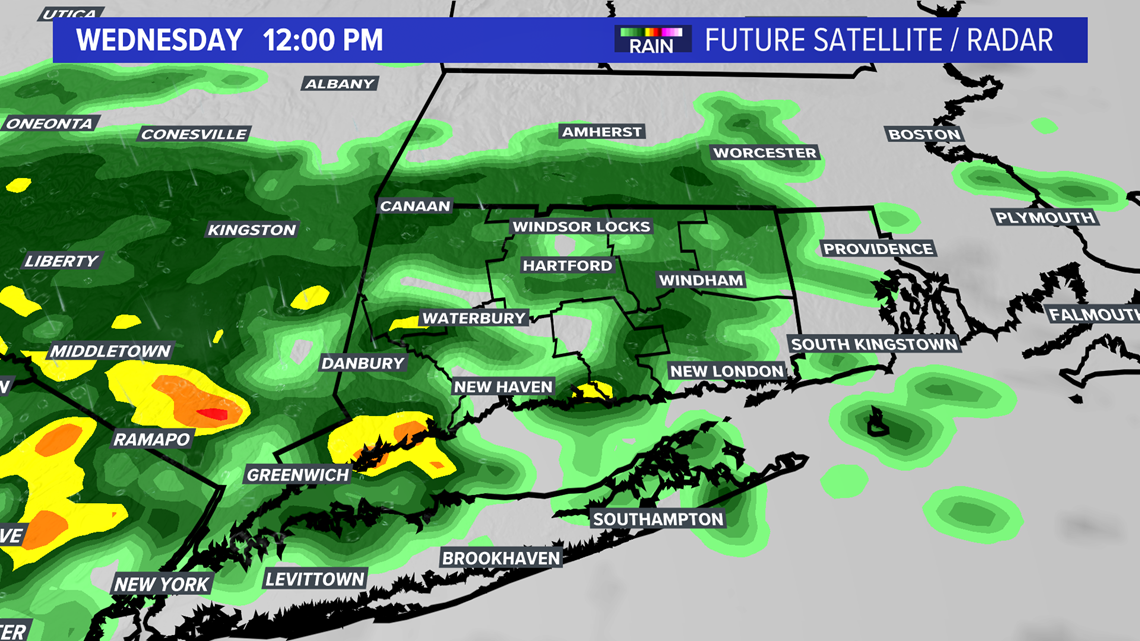
Noon Wednesday: Intermittent rain showers under cloudy skies. Scattered downpours may be out there, but this isn’t the main event yet.

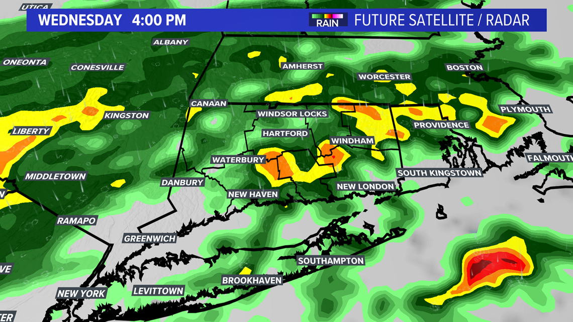
4 PM Wednesday: A few scattered downpours with more consistent rainfall developing across the area. To many people, it’s “just a rainy day” so far.

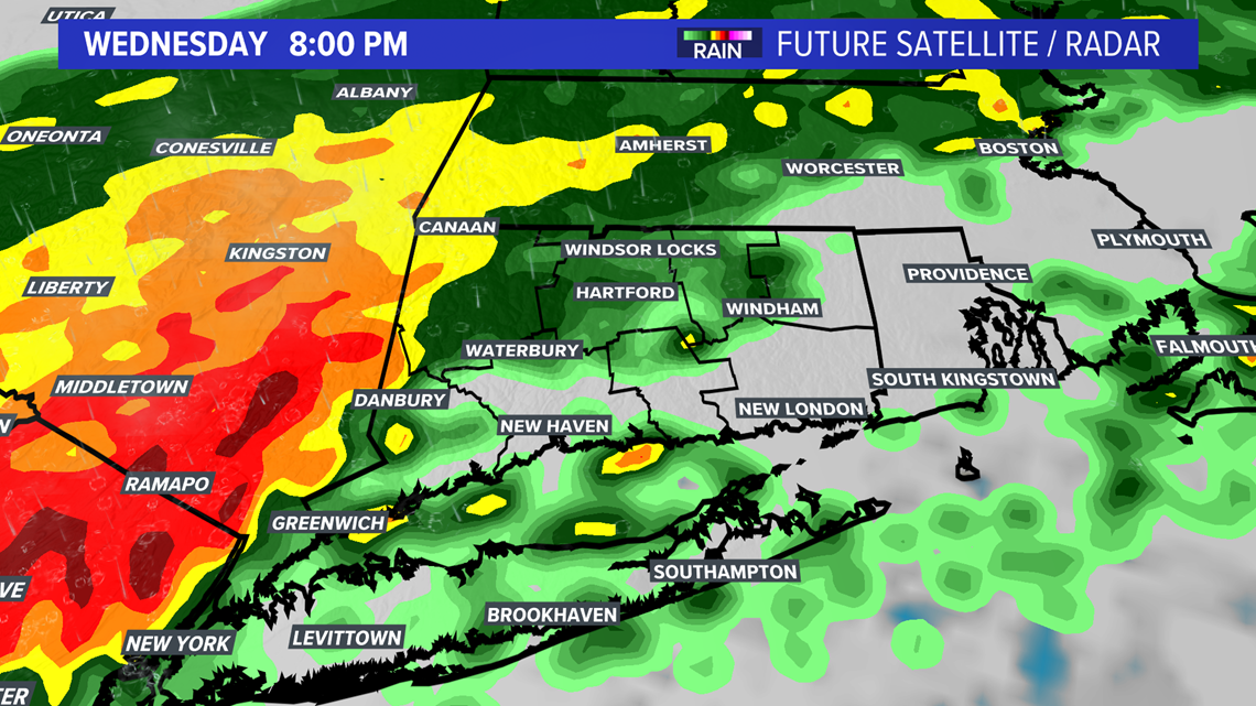
8 PM Wednesday: Around this time, the flooding chance really starts to rise. Heavier downpours move in during the evening, with the heavy rain becoming more consistent as the evening progresses.

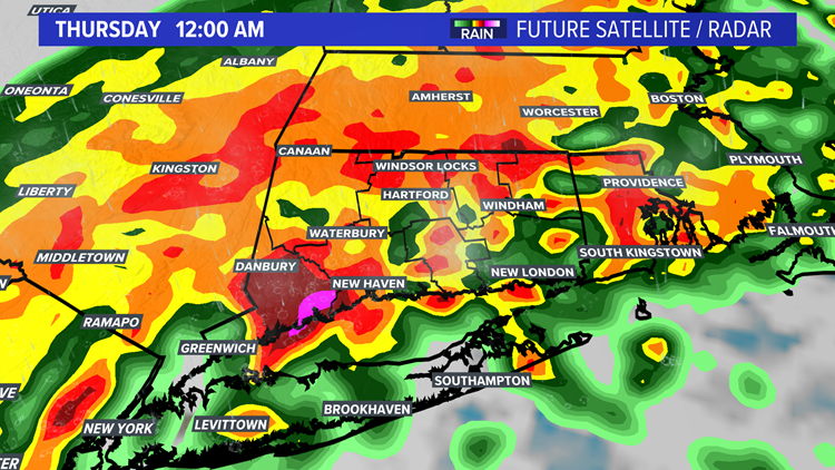
Midnight: This is game time. Torrential rain across the state, with flash flooding likely. Travel on roads may be extremely difficult with flooded roadways and poor visibility. Some severe weather is also possible in southern Connecticut around this time. The more serious severe weather threat is just to our south, but there is a low chance for a spin-up tornado in some of the stronger rain cells.


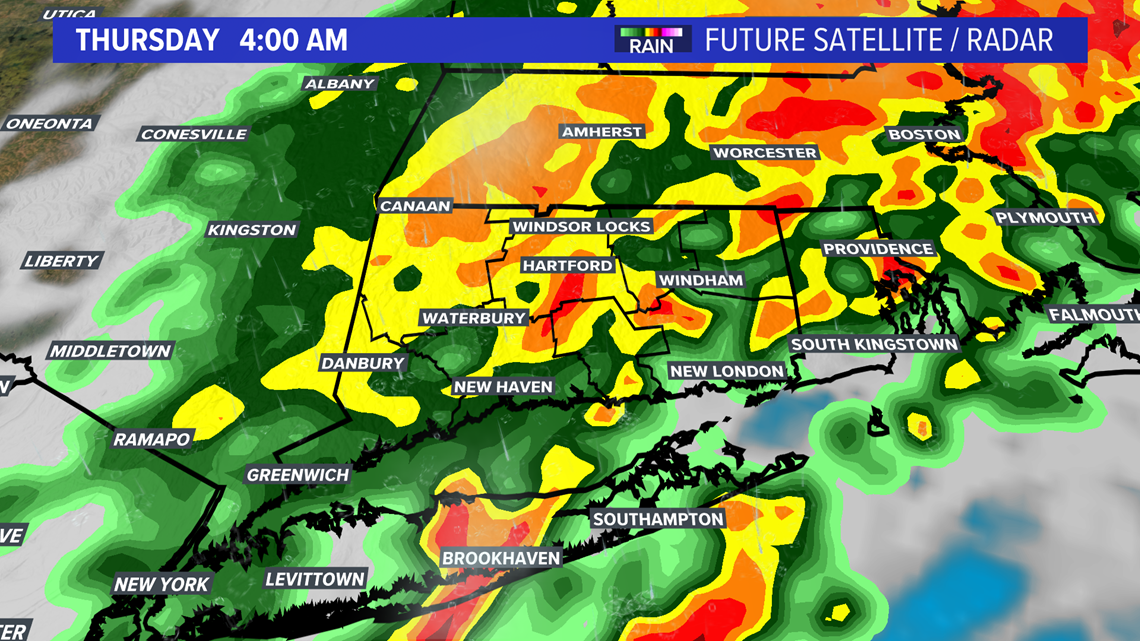
4 AM Thursday: Leftover pockets of heavy rain, but the bulk of it is starting to taper off a bit. There may be a period of some gusty winds in the 30-40 mph range during the early morning hours. We'll be monitoring for power outages.

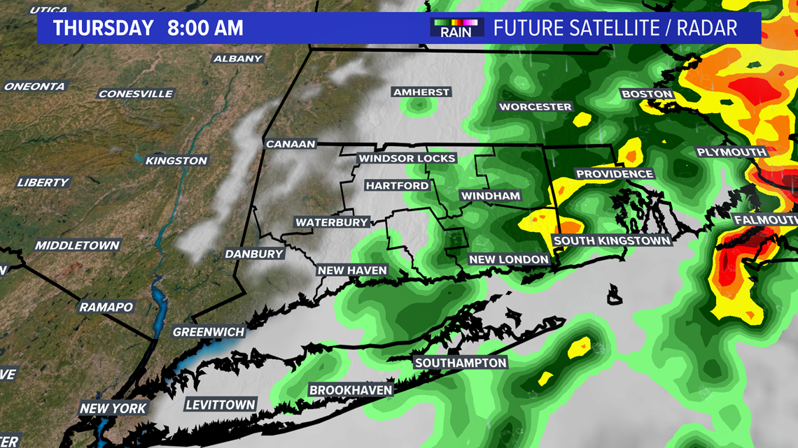
8 AM Thursday: The rain will likely be moving out around this time, with some clearing skies approaching from the west. The rest of the day should be free of rainfall with sunshine and temperatures around 70.

After the storm moves out, sunshine moves in for several days. It's looking like a pleasant holiday weekend as we head into Labor Day!
HERE ARE MORE WAYS TO GET FOX61 NEWS
Download the FOX61 News APP
iTunes: Click here to download
Google Play: Click here to download
Stream Live on ROKU: Add the channel from the ROKU store or by searching FOX61.

