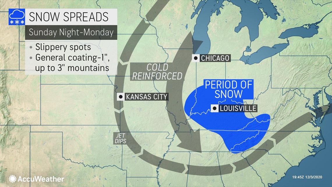
After winter's quick visit left areas around the Great Lakes and interior Northeast buried under heavy snow at the beginning of December, another winter storm is already setting up to take aim at the region for the first weekend of the month -- and it could potentially evolve into the season's first nor'easter.
"It looks like as we go forward we are going to see a strengthening storm coming up the Eastern Seaboard, but the forecasting dilemma, and it always is, is the exact track of the storm," AccuWeather Chief Broadcast Meteorologist Bernie Rayno said on Thursday, a day after highlighting the potential for mischief and mayhem to take place with the developing storm.
Rayno added that all of the ingredients for a stronger storm are already coming together. First, the storm that brought snow to parts of the central and southern Plains during the middle of the week will begin to move into the Southeast.
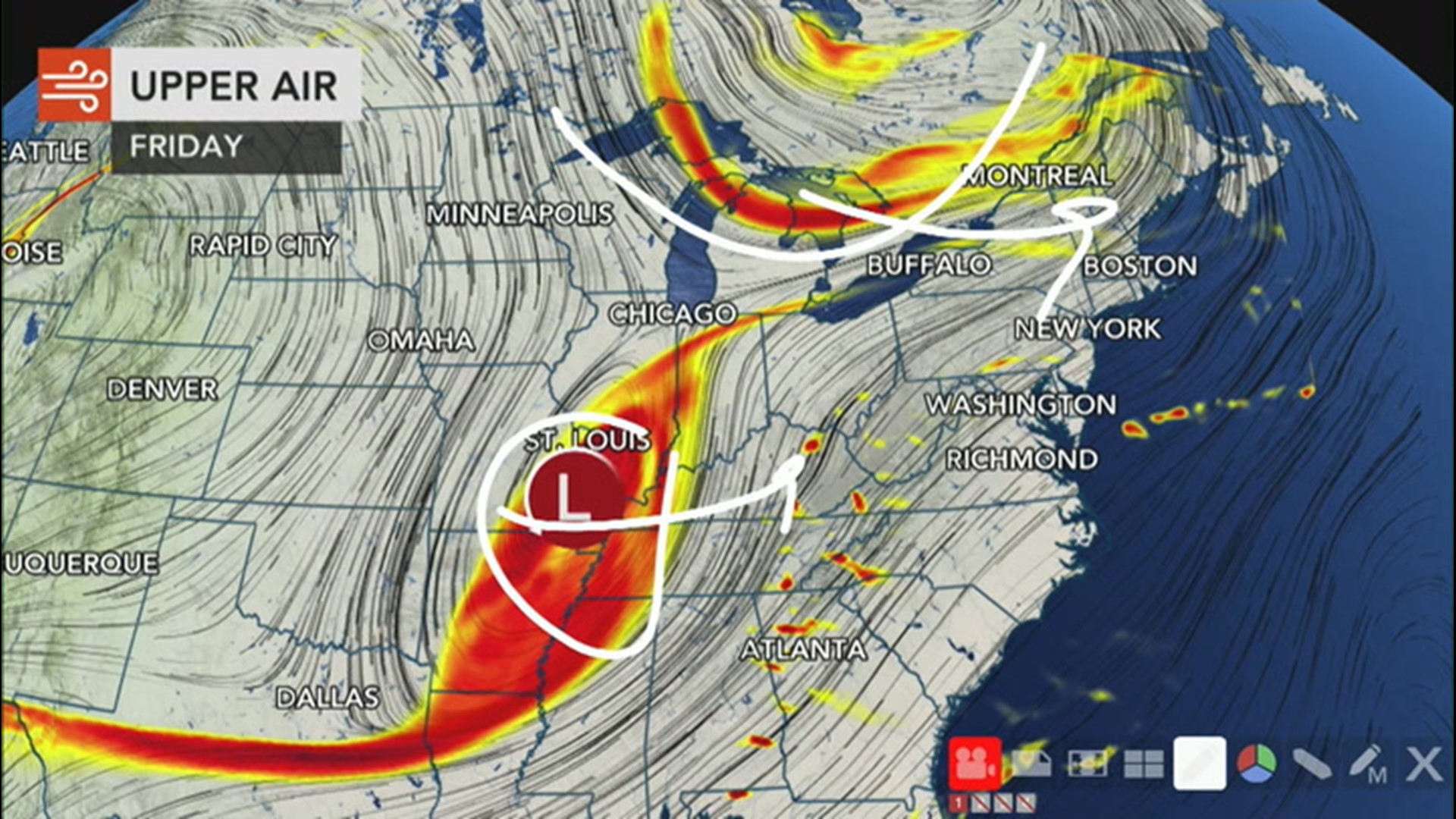
At the same time, the jet stream will sink south of the Great Lakes region through the end of the week. According to Rayno, this will help to bring extra energy and moisture that will allow the storm to strengthen.
As the storm moves into the Southeast on Friday, it will trigger rain and thunderstorms across much of the region. Thunderstorms will be most likely across southern Alabama, southern Georgia and northern Florida.

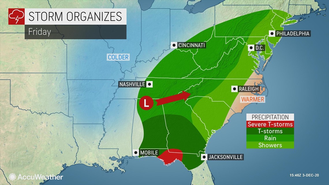
Some of these storms can become strong enough to produce downpours, strong wind gusts and even an isolated tornado, especially in the panhandle of Florida.
After drenching the Southeast late this week, the storm will shift into the mid-Atlantic. That's when it will be able to tap into that extra energy from the jet stream and will really begin to strengthen.

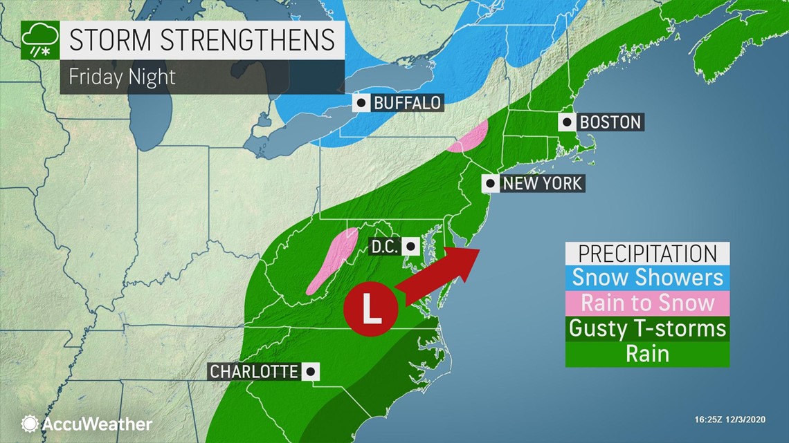
"In addition, it's going to be this part of the jet stream, the northern branch, that will be steering [the] storm to the east or to the northeast," Rayno explained.
A more northeasterly path would take the storm through New England, but a more easterly track would take the storm out to sea.
AccuWeather forecasters believe that the most likely scenario is a path in between the two extremes. This is a track that will be offshore but will still parallel the coast, added Rayno.

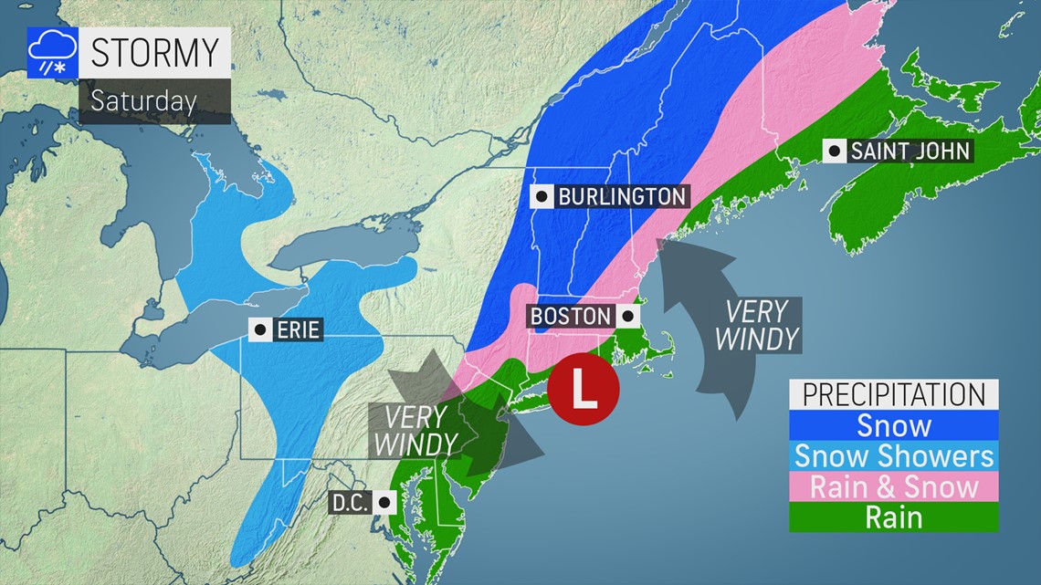
The exact track of the storm will determine whether or not this storm will become the season's first nor'easter. A nor'easter is any large storm that brings northeasterly winds along the Atlantic coast of North America, according to the National Weather Service (NWS).
Forecasters will also be monitoring for the potential for this storm to go through the process of bombogenesis, or a rapid strengthening that occurs when the central barometric pressure of a storm plummets by 0.71 of an inch of mercury (24 millibars) within 24 hours. When a storm undergoes this level of intensification, it is referred to as a bomb cyclone.
If that type of significant strengthening takes place, the storm could bring high winds and extensive power outages throughout the Appalachians and Atlantic coast with widespread flooding rain along the coast and very heavy snowfall across the interior of the Northeast.
The weather system could unleash widespread impacts across the Northeast even if it doesn't intensify enough to be classified as a bomb cyclone as it tracks along the Eastern Seaboard.

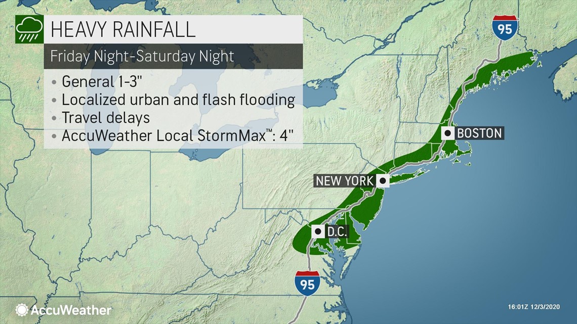
"Rain will soak areas from Virginia to southern New England with the storm," AccuWeather Senior Meteorologist Joe Lundberg said, adding that some of the heaviest rain can arrive and spread across the Interstate 95 corridor throughout the day on Saturday.
Cities including Washington, D.C., Baltimore, Philadelphia, New York City, Boston and Portland, Maine, could pick up 1-3 inches of rain in less than 12 hours. This could lead to flash flooding in low-lying and poor-drainage locations.
As the heaviest rain will target coastal areas, an influx of colder air will allow precipitation to fall as snow farther inland. Rayno added that the jet stream sinking south into the weekend will allow cold air to rush in on the backside of the storm.

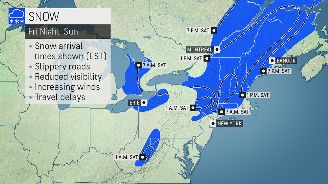
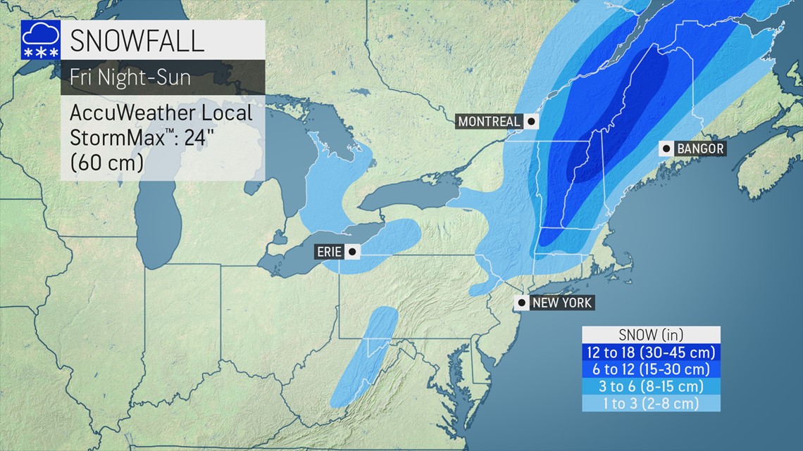
"Cold air drawn into the storm's circulation will mean heavy, wet snow for places, particularly in the higher terrain from western Massachusetts up into interior Maine," added Lundberg. "However, a few inches of snow will accumulate even down into the mountains of West Virginia."
The heaviest snow is expected to fall across northern New England, where 6-12 inches of snowfall will be likely. Snowfall totals can even reach above a foot in northeastern Vermont, New Hampshire and western Maine. This is the most likely location for the AccuWeather Local StormMax™ of 24 inches to occur.

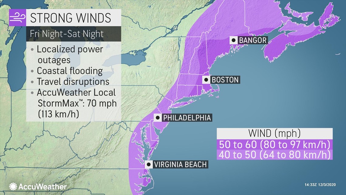
Strong wind gusts expected with the intensifying storm will only add to the disruptions caused by soaking rain and heavy snow.
Lundberg warned that wind gusts can reach over 50 mph along the New England coast at the height of the storm. Winds of this magnitude could cause power outages and even localized damage in the region through the weekend. Driving winds can also dangerously reduce visibility in areas of heavy rain and snow.

As quickly as the storm will arrive, it will be just as quickly swept away on Sunday. Areas of lake-effect snow will linger near the Great Lakes, but dry and chilly conditions will settle over the Northeast into the beginning of next week.

