HARTFORD, Conn. — Hurricane season begins June 1.
Going into last summer, conflicting factors made it challenging to predict how the season would play out. A developing El Niño in the Pacific, which usually suppresses tropical activity in the Atlantic, was at odds with record warm sea surface temperatures in the Atlantic, which serves as fuel for potential storms.
As a result, the seasonal forecast from NOAA was for a near-average season.
In the end, the warmer Atlantic water won out; 20 storms were named, well above average. Seven hurricanes formed, three of which reached major category three or higher status; both of these were average numbers for a season.
Heading into this summer, the setup atmospherically is different.
"We're getting away from an El Niño, which means fewer storms. We're getting into a situation atmospherically for more storms," Ken Graham, the director of the National Weather Service, told FOX61 at a recent stop of the hurricane awareness tour in Albany, N.Y.

El Niño or La Niña? The starting point for tropical outlooks
Traditionally, the phase of ENSO (The El Niño Southern Oscillation) in the Pacific Ocean is a strong guide for the hurricane season outlook.
El Niño summers tend to have stronger vertical wind shear in the Atlantic basin.

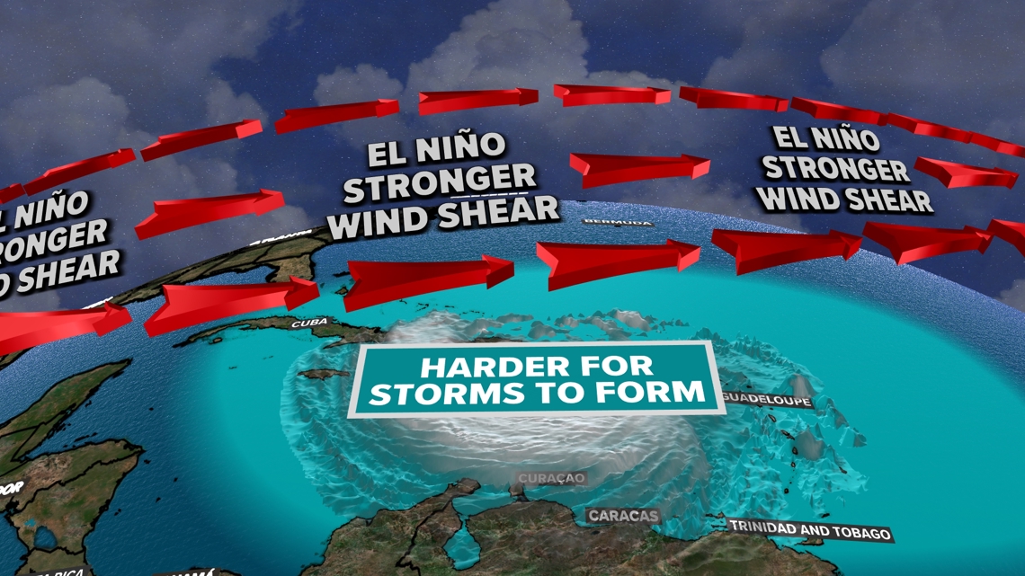
This can counteract tropical development, ripping storms apart as they attempt to form.
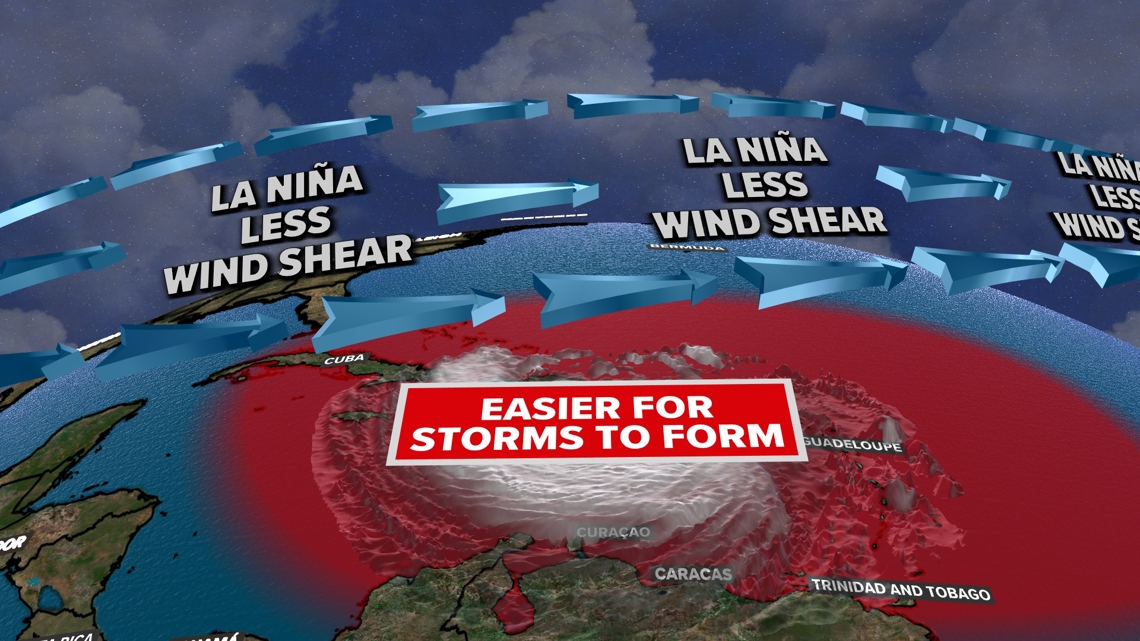
The opposite is true for La Niña summers in the Atlantic.
"That tends to reduce vertical wind shear over portions of the tropical Atlantic," Michael Brennan, director of the National Hurricane Center said. This can make it easier for tropical systems to organize.

El Niño is in the process of fading; or in other words, warmer-than-average water temperatures in the eastern equatorial Pacific are cooling.

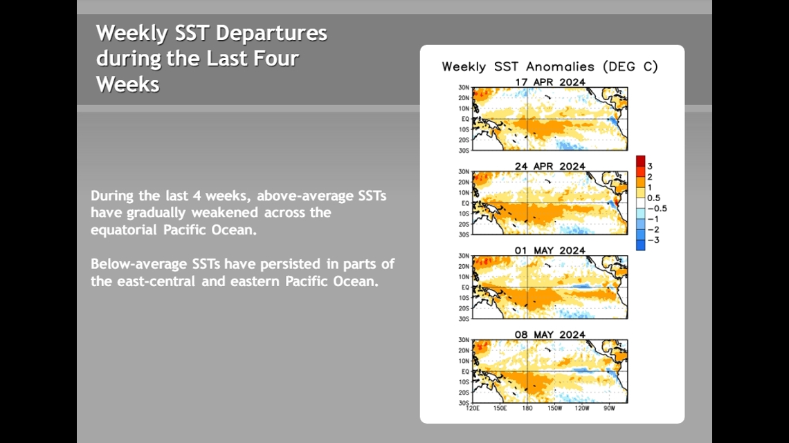
In addition to water at the surface cooling, the water below the surface in this region is turning cooler than average, a strong sign for a developing La Niña.
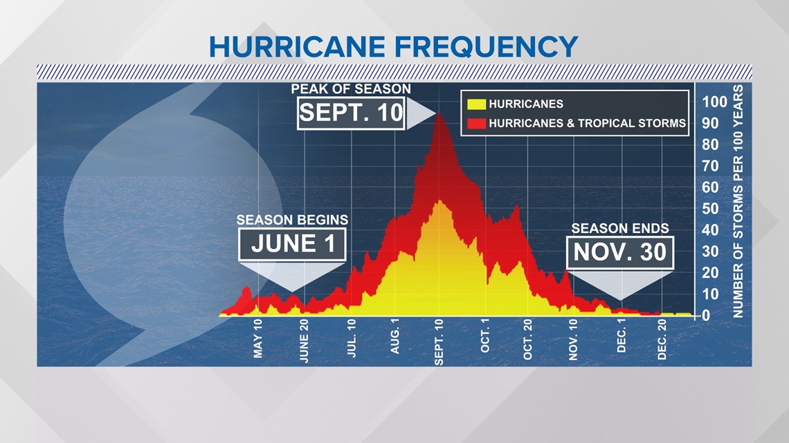
Computer model guidance suggests a turn to La Niña conditions during hurricane season, which usually peaks in early to mid-September.

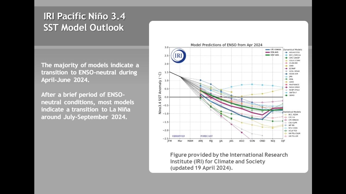
How quickly La Niña develops can have an impact on how quickly the atmosphere responds.
That said, this development leads forecasters to believe the vertical wind shear in portions of the Atlantic will be more favorable for storms to develop.
Record warmth in the Atlantic Ocean
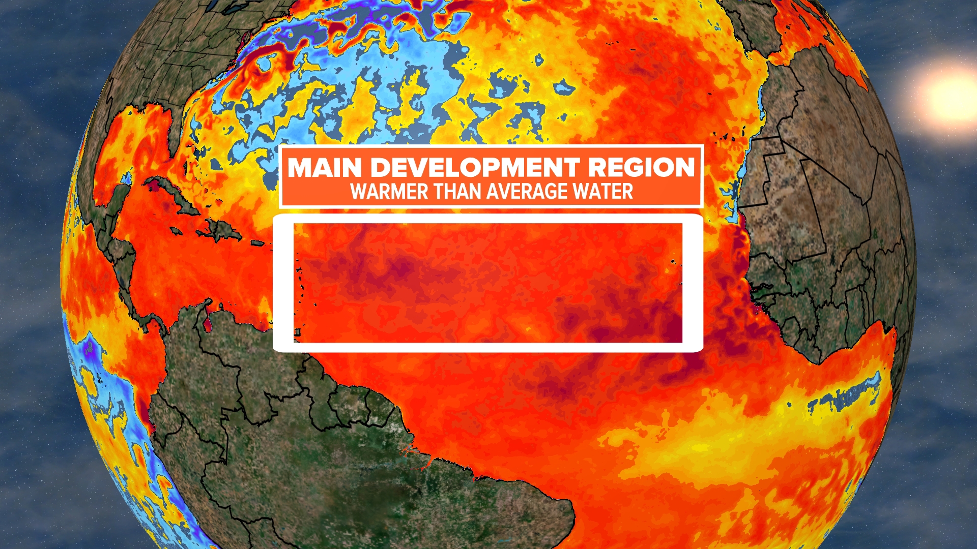
If the atmospheric set-up in the Atlantic is favorable for storm development, the next question is how warm the sea surface temperatures are in the Atlantic.
The water has been running a streak of record-warm levels for more than a year.

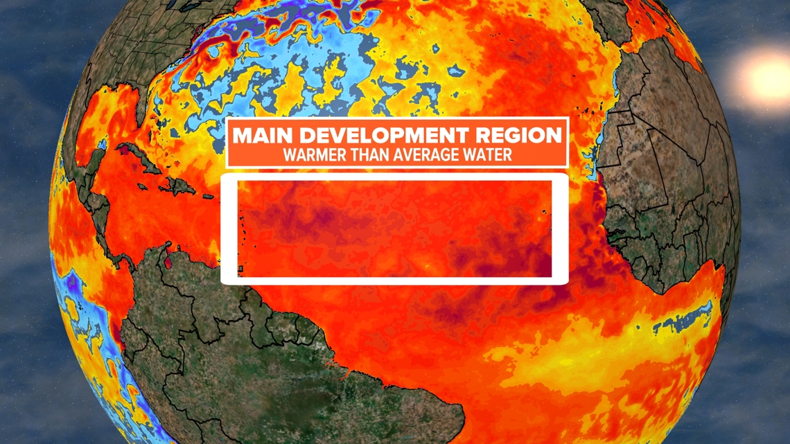
"We’re here in May. We see ocean temperatures in parts of the main development region in the Atlantic that are already as warm as they might be later in the summer," Brennan said.
"The combination of those factors could certainly lead to a busy season," Brennan said.
The hurricane season outlook
NOAA's official outlook will be issued May 23. However, discussing the season ahead with top officials, it's clear these factors are top of mind and leaning them in a more active than average direction.
A number of private and academic outlets have issued their projections for the upcoming season.
One of the most prominent is Colorado State University. Despite being in Colorado, their tropical meteorology team has pioneered hurricane research, and has been issuing annual outlooks since 1984.
An average season has 14 named storms, seven of which become hurricanes, and three of those that reach major (category three or higher) status.
Citing the factors discussed above, the team at CSU predicts the Atlantic hurricane season will be "extremely active."

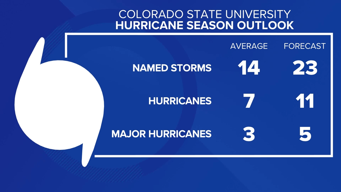
While there is skill in projecting the number of storms each season, where the storms will form or whether they will hit land is much more challenging.
NOAA does not predict which areas of the country will be more at risk, while some outlets do choose to experiment with this.
All it takes is one storm to make it a memorable one, and the message from Brennan is "everybody in Connecticut has to be ready every year for potential hurricane and tropical storm impacts."
Southern New England has been affected by several tropical systems in recent years, but it's been a long time since a direct hurricane landfall in New England. The last was Hurricane Bob in 1991.
---
Ryan Breton is a meteorologist at FOX61 News. He can be reached at rbreton@fox61.com. Follow him on Facebook, X and Instagram.
Do you have a story idea or something on your mind you want to share? We want to hear from you! Email us at newstips@fox61.com
---
HERE ARE MORE WAYS TO GET FOX61 NEWS
Download the FOX61 News APP
iTunes: Click here to download
Google Play: Click here to download
Stream Live on ROKU: Add the channel from the ROKU store or by searching FOX61.
Stream Live on FIRE TV: Search ‘FOX61’ and click ‘Get’ to download.

