

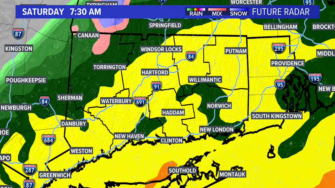
CONNECTICUT, USA — Rain will fill in heading into Saturday morning as a developing nor'easter approaches. This will be a complex and dynamic storm system, which is the main reason why it's been so tough to pin down in the forecast!
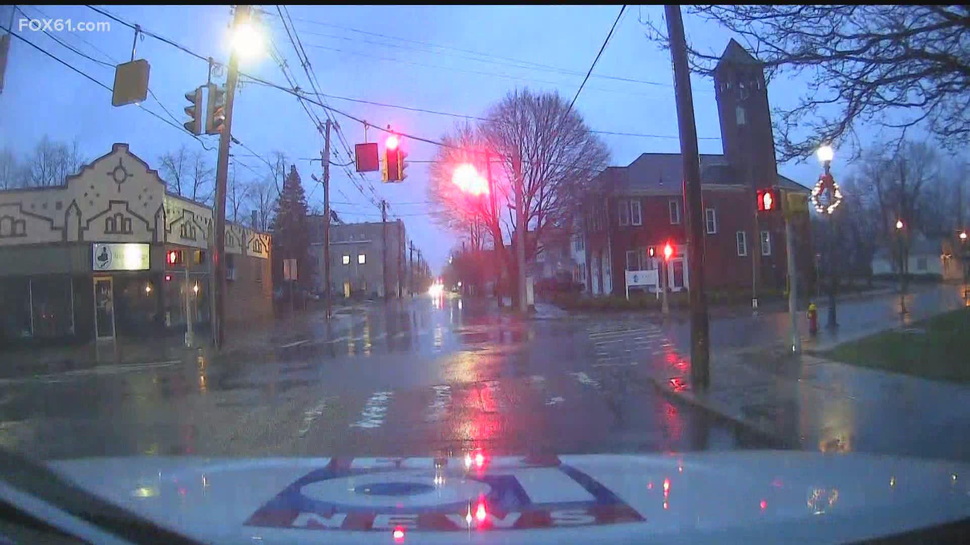
Rain will come down heavy at times early Saturday morning.

The heavy snow is causing power outages. Scattered outages were reported across the state through the early afternoon, but later in the afternoon those numbers began to climb dramatically, from around 3,000 customers at about 3 p.m. to over 11,000 by 4:15 p.m. By 7 p.m., that number had dropped to about 5500 customers.
At one point, over 5,000 customers were without power in Stafford alone. By 7pm, that number was down to 1266 customers, according to Eversource's outage map. Mansfield has about 1300 customers without power.
I-84 was shut down for a 12-mile stretch from Stafford to Willington early in the evening due to multiple tractor-trailer crashes. The highway reopened after more than an hour, but police report numerous spin-outs and crashes across the state, especially on secondary roads. Don't travel unless you really must!
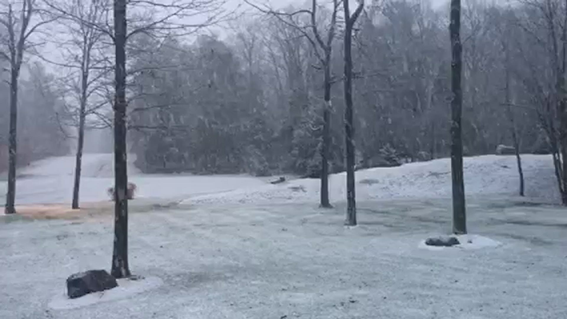
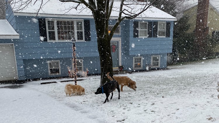
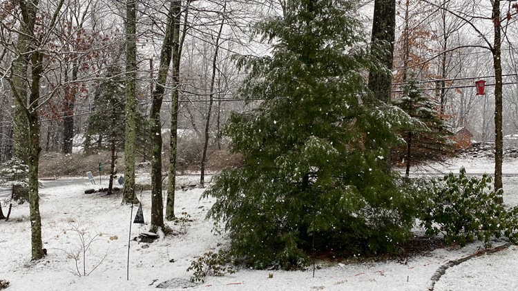
FOX61 viewers Pete & Paulina Losey shared a video of heavy wet snow falling in Goshen Saturday morning.
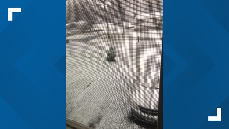
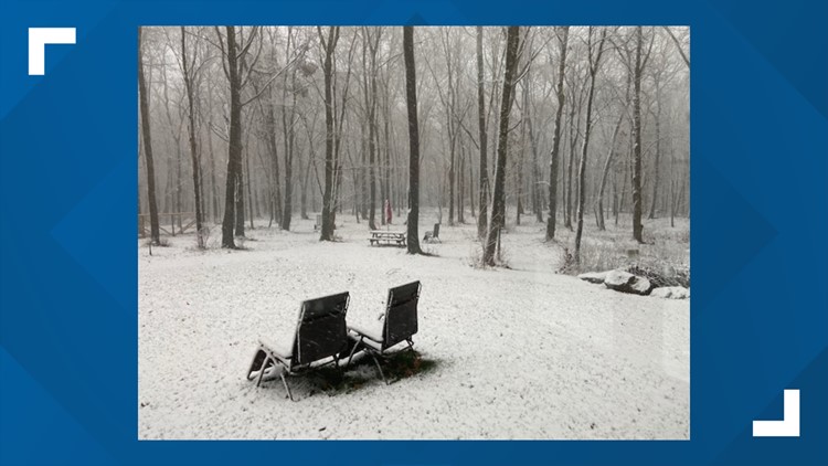
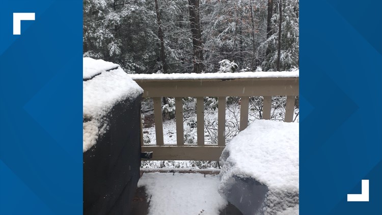
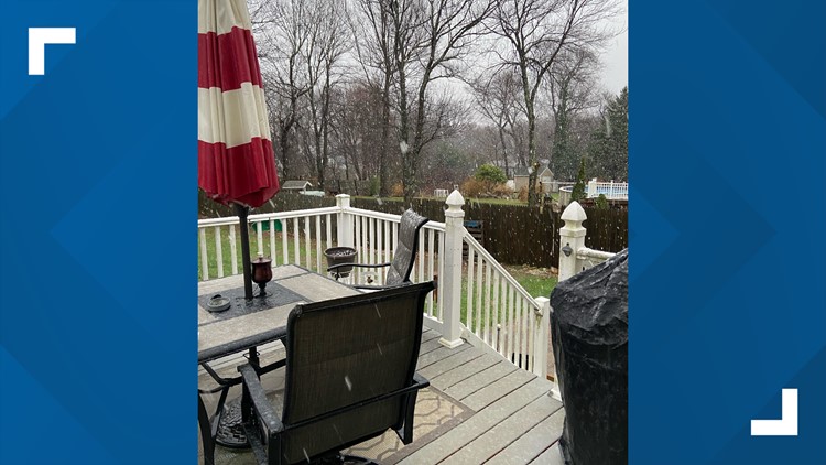
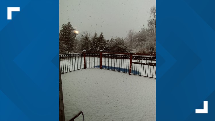
Check out a gallery of snow from across the state, below.
#SHARE61 | Connecticut's first Nor'easter of the winter season


Officials said a Parking ban will be in effect for all public roadways in the Town of Plainfield:
The parking ban will begin when one (1) inch of snow has fallen and will remain in effect until the Highway Department has cleared the roadways, as per Town Ordinance #109. All vehicles must be off the roadway. Any vehicles observed to be in violation of this Ordinance may be towed at the owner’s expense and subject to fines.
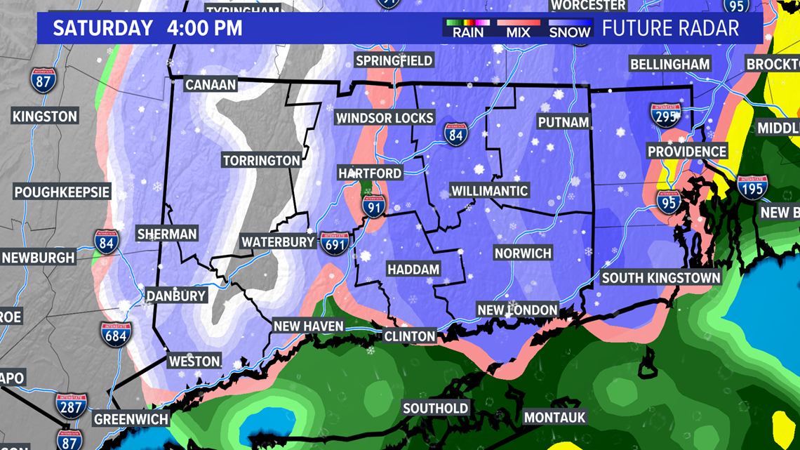
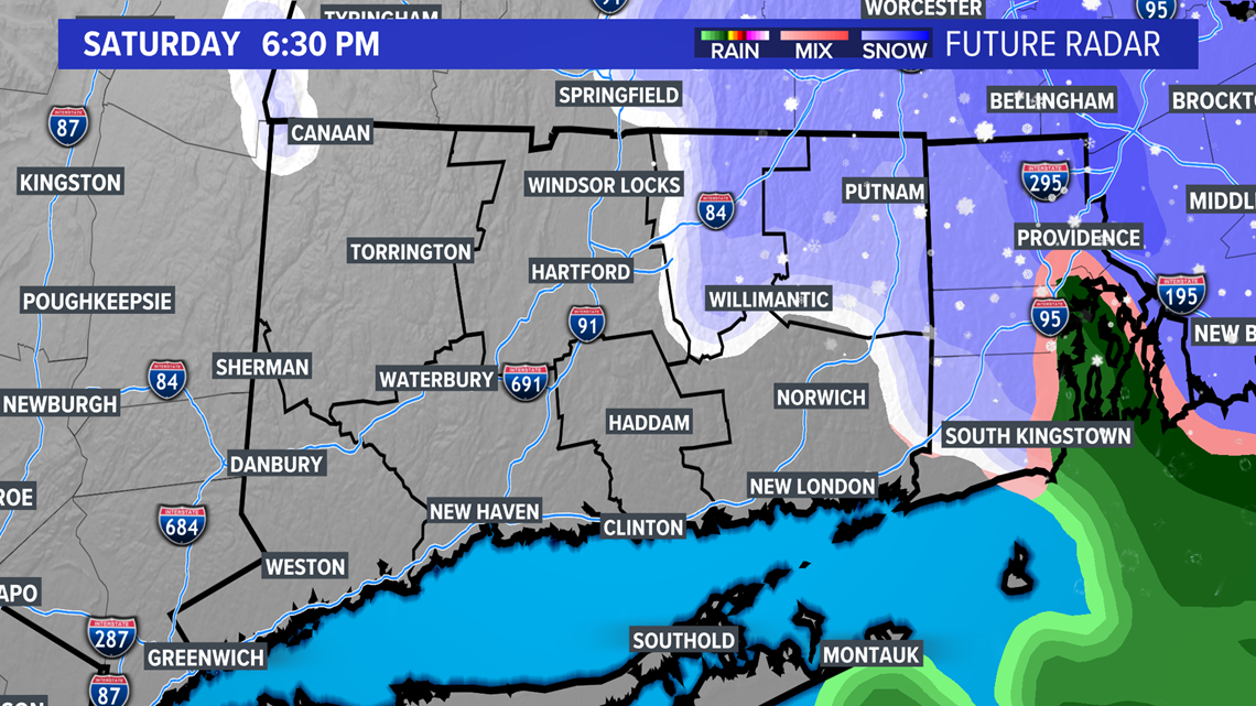
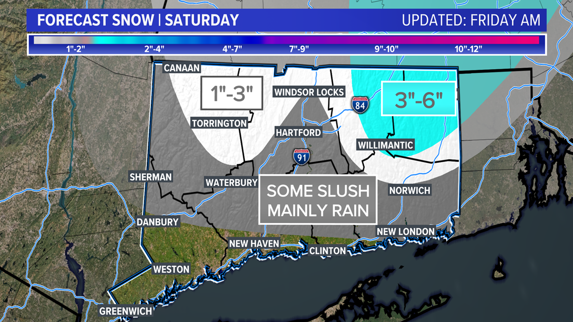
Then that changeover works south through the morning and into the afternoon. Flakes possible down to the shore although I wouldn't expect much/any accumulation there.

The storm wraps up in the evening.

This looks like a nasty storm including tough travel, strong winds, heavy wet snow, outages... At least it's a Saturday? The outages will be more widespread where snow totals are near 6" as wet heavy snow weighs down trees and powerlines.
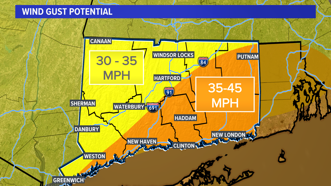
The wind won't help, with gusts up around 40-45 mph, especially in southern CT. Be prepared for power outages and hope the lights stay on.

How much snow remains a really tough question because there will be a band of snow that develops producing snowfall rates of 1"-3"/hour and there's still a question as to where that sets up. Right now we have it setting up through northeastern CT but if it's a little farther south then it's game on for some of those bigger totals elsewhere.
Since temperatures will be marginal (not too cold, near or above freezing). elevation will play a roll with more in the hills, less in the valleys and the lowest at the shoreline.

One thing is for sure, cancel your outdoor plans on Saturday. Sunday will be the pick of the weekend, albeit a chilly day.
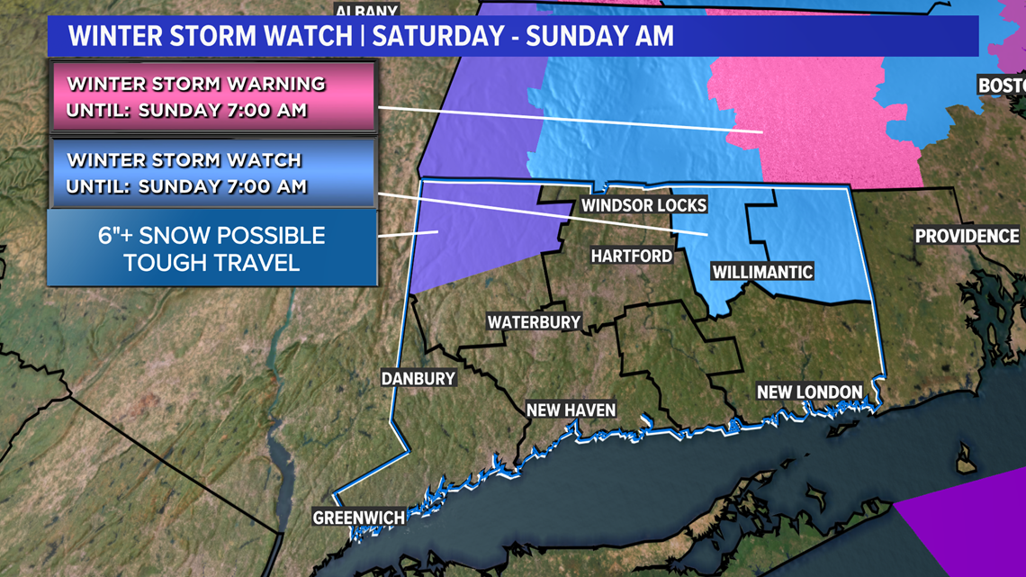
The chances for big snow amounts (6"+) are higher in northeastern CT. These may get upgraded to Winter Storm Warnings as confidence in the forecast increases.

After the storm moves out late Saturday, we'll see a chillier weather pattern for several days as we head into next week.
Temperatures will get cold Sunday night and there could be slippery roads into Sunday morning.
Overall, it'll be typical December weather out there!