CONNECTICUT, USA — Hurricane Lee formed last week, and continues to move through the Atlantic. Fortunately, it has not hit any land yet. Does it feel like we've been talking about this for days? We have! This is a classic "long track" hurricane, with its origins as a tropical wave off the west coast of Africa early last week.
Monday, it is located north of the Leeward Islands, avoiding a hit by about 300 miles.
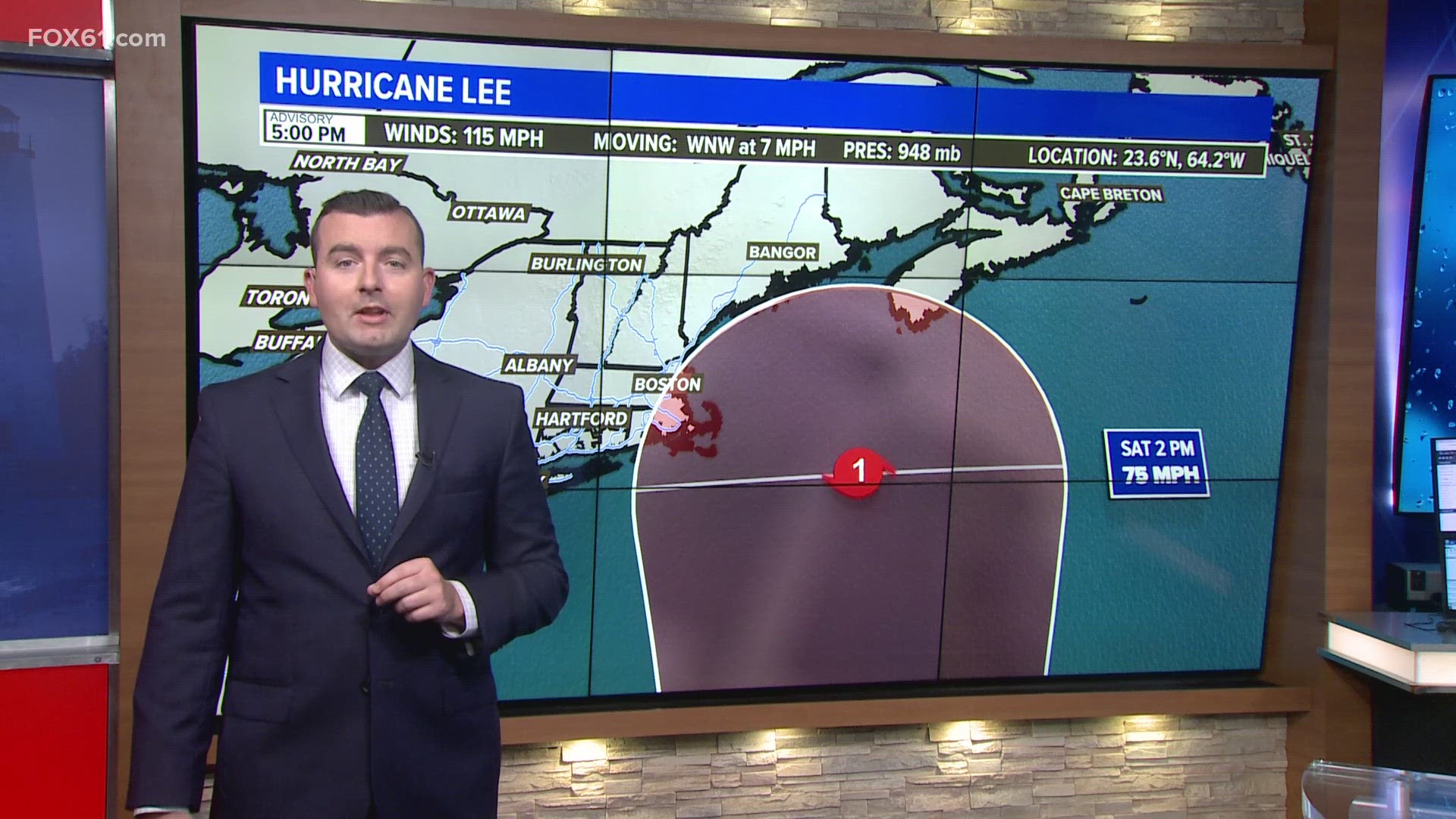
Here is the latest forecast track of the storm, which is updated every six hours by the National Hurricane Center.
Parts of southeastern New England including Cape Cod are now in the "forecast cone," or cone of uncertainty. This represents where the center of the storm could track, given the average error in the forecast at that time. It does not represent the impacts from the storm, which can extend well outside of it depending on where the storm tracks.
Once it gets up to New England, Lee may become more like a strong nor'easter. This means the core of the hurricane force winds will weaken, but a larger area of strong winds will develop on both sides of the storm. If it comes close enough to the New England coast, there could be gusts over 60 mph in eastern New England, particularly for places like Nantucket and parts of the Maine coast. These specific details will remain unclear until the track becomes more solid, probably Wednesday.
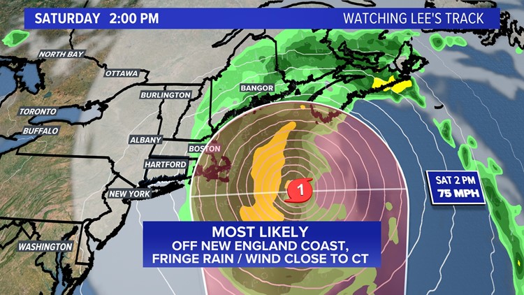
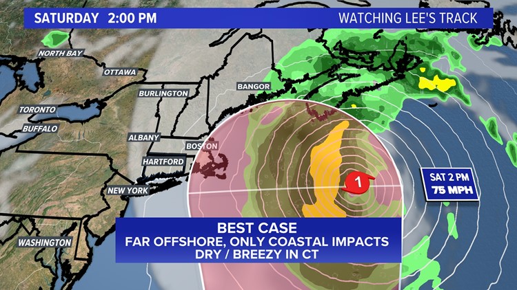
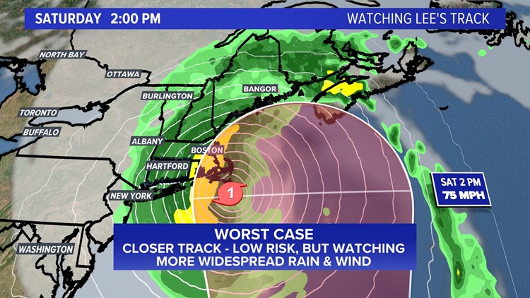
Hurricane Lee track scenarios
Large, breaking waves and rough surf are a guarantee at Atlantic beaches. Coastal flooding is also a concern, mainly outside of Long Island Sound, which is generally protected from the wave action with a track far to our east.
If you have plans this weekend on the Cape, islands, or in Maine, especially pay attention to this forecast and consider your options if in a day or two it looks like it does now. We have the benefit of time, being this far out!
In Connecticut, we may see some rain and gusty wind on the fringe of the storm, but a direct hit remains unlikely. It's possible if the storm track shifts a bit east again, we may not see much at all, other than a gusty breeze. As it stands now, this is more of a concern for eastern New England, but we will continue to watch any shifts in the track closely.
The Atlantic hurricane season runs from June 1 to Nov. 30. It usually peaks around Sept. 10.
The National Ocean and Atmospheric Administration warned in August that this year’s hurricane season would be above normal. Between 14 to 21 named storms are forecast. Of those, six to 11 could become hurricanes, with two to five of them possibly becoming major hurricanes.
---
Have a story idea or something on your mind you want to share? We want to hear from you! Email us at newstips@fox61.com
---
HERE ARE MORE WAYS TO GET FOX61 NEWS
Download the FOX61 News APP
iTunes: Click here to download
Google Play: Click here to download
Stream Live on ROKU: Add the channel from the ROKU store or by searching FOX61.
Steam Live on FIRE TV: Search ‘FOX61’ and click ‘Get’ to download.


