HARTFORD, Conn. — Temperatures will rise to near-record levels this week, but even with fall warmth, everyone knows winter isn't too far off.
So, what may the winter be like?
NOAA has made its first take.
The Climate Prediction Center issued its outlook for December, January, and February, the months considered meteorological winter, last week.
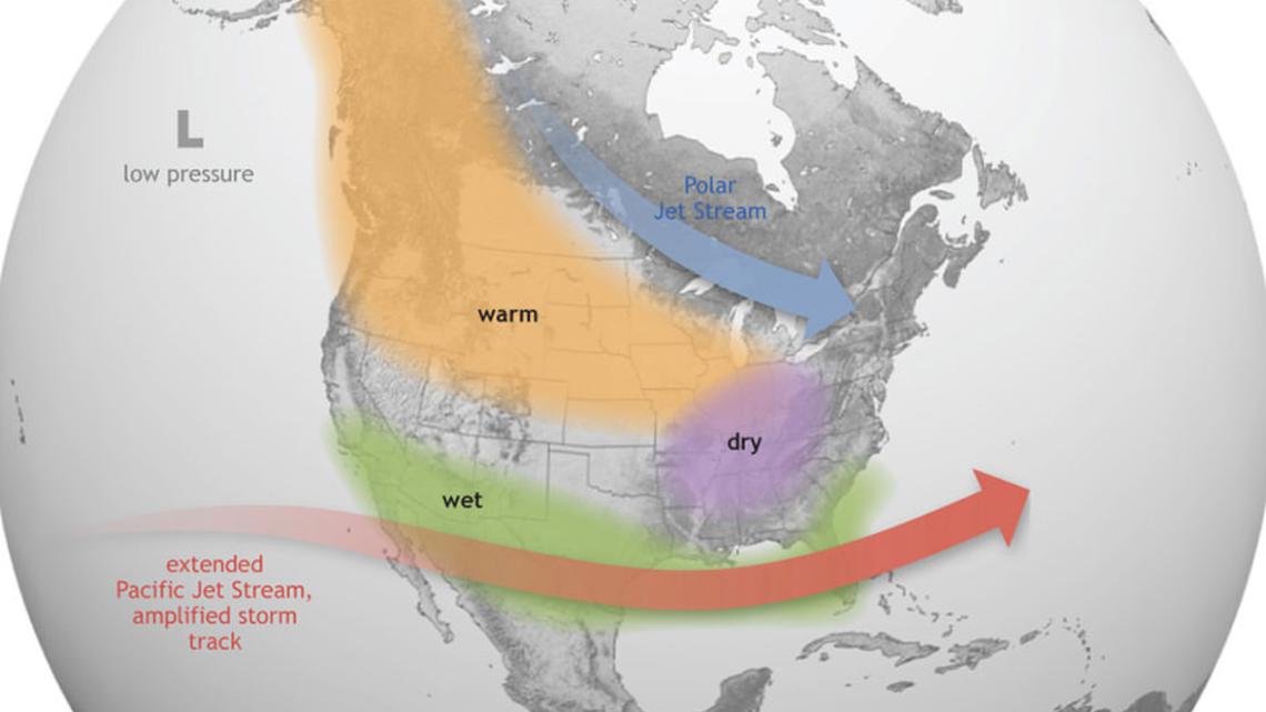
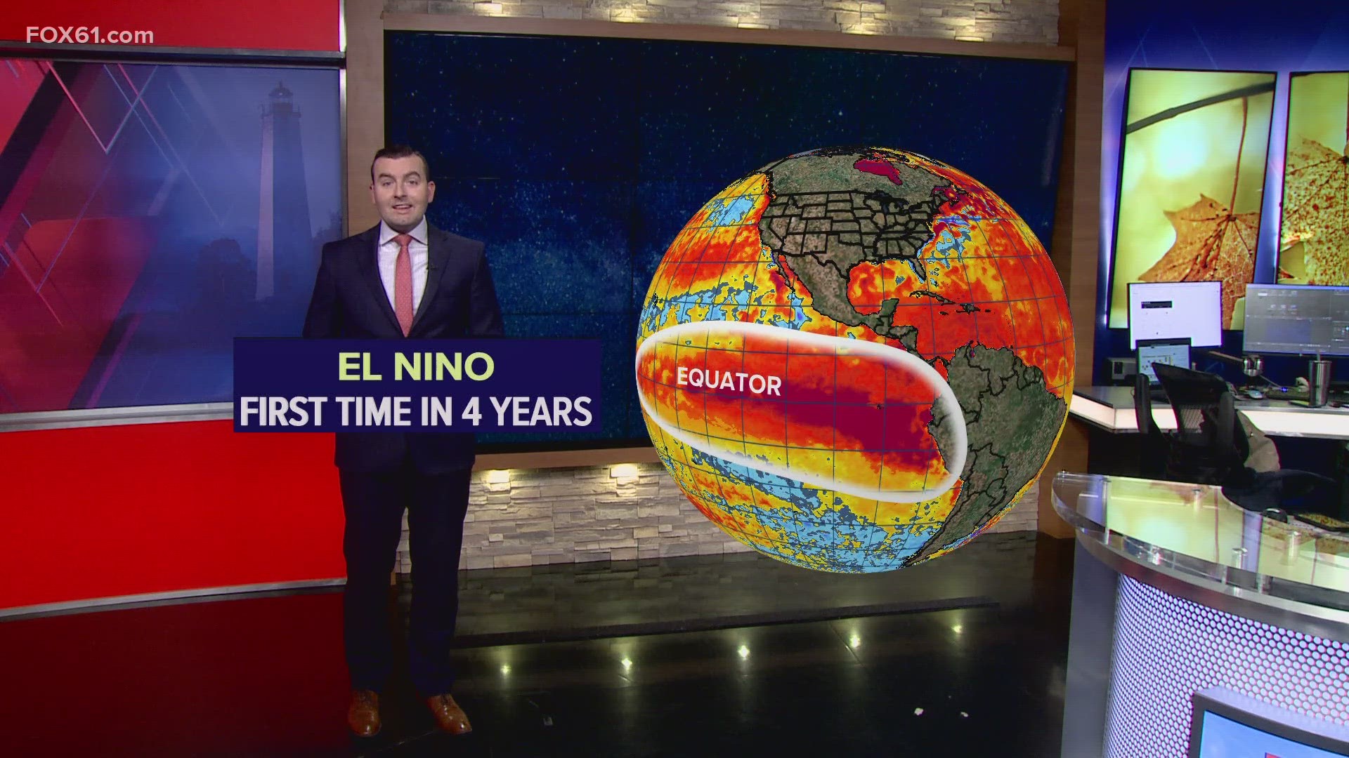
The largest factor in the outlook is El Niño, which is expected to continue. Warmer than average temperatures in the equatorial Pacific Ocean, the opposite of the cooler waters during La Niña last winter, can influence the jet stream and weather pattern.


That's almost always the starting point for winter outlooks. There are other factors, including the temperature patterns and snow cover in Eurasia that can influence the jet stream, that usually come into focus during the month of November.
The outlook from NOAA calls for a 40% to 50% chance of above-average temperatures in southern New England. In northern New England, it's a 50% to 60% chance.
So what does that mean? Generally speaking, the odds favor another warmer-than-average winter.


As for precipitation, NOAA didn't take a strong stance for New England. This isn't unusual. We often end up in the "gray area" of their outlooks, called equal chances. This year, they are leaning toward above-normal precipitation in southern New England, rating it a 33% to 40% chance. This doesn't account for only snow. The precipitation forecast is for total liquid: rain and melted snow.
A large area of the southern United States is expected to see above-average precipitation this winter. That's due to what's often an active storm track off the Gulf of Mexico in El Niño winters.


From this outlook, we can infer a few things:
- Odds favor a warmer-than-average winter in New England.
- Total precipitation may be a bit higher than average.
- How much of that falls as snow remains a question, and will be based on the individual patterns going into those storms. We can infer possibly less snow than average due to the warmer temperatures expected.
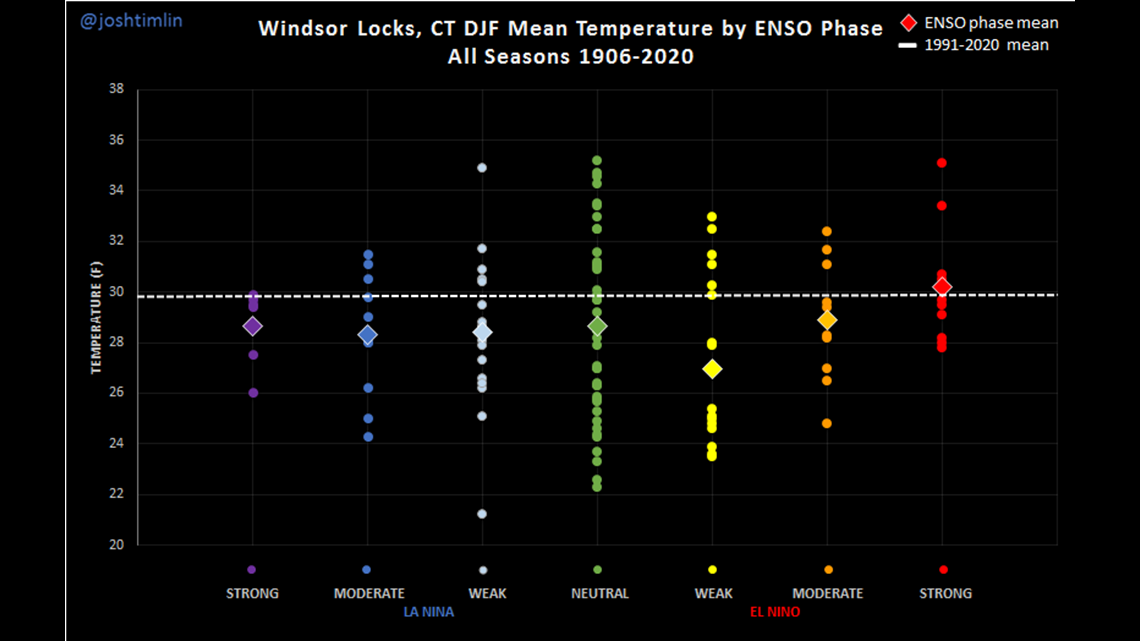
Looking at the data for Bradley: Moderate to strong El Niño winters tend to have warmer than average temperatures. Weak El Niño winters tend to be cooler than average.


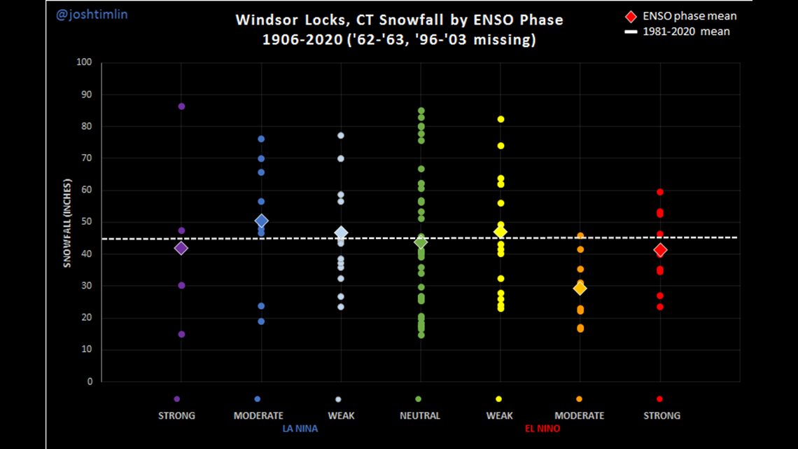
Moderate to strong El Niños tend to produce less snow than average.


The next update from NOAA will be available on November 16.
While El Niño is always a reasonable starting point, hopefully, other factors developing over the next few weeks will help lead us in one direction or another.
FOX61 will produce a Connecticut-specific winter outlook later in the month. Last year's call for a warm winter was correct. But we received even less snow than we were anticipating, given the warm weather.
Ryan Breton is a meteorologist at FOX61 News. He can be reached at rbreton@fox61.com. Follow him on Facebook, X and Instagram.
---
Have a story idea or something on your mind you want to share? We want to hear from you! Email us at newstips@fox61.com
----
HERE ARE MORE WAYS TO GET FOX61 NEWS
Download the FOX61 News APP
iTunes: Click here to download
Google Play: Click here to download
Stream Live on ROKU: Add the channel from the ROKU store or by searching FOX61.
Steam Live on FIRE TV: Search ‘FOX61’ and click ‘Get’ to download.

