
CONNECTICUT, USA — A few showers move through overnight, then we are in for a summer preview Monday.
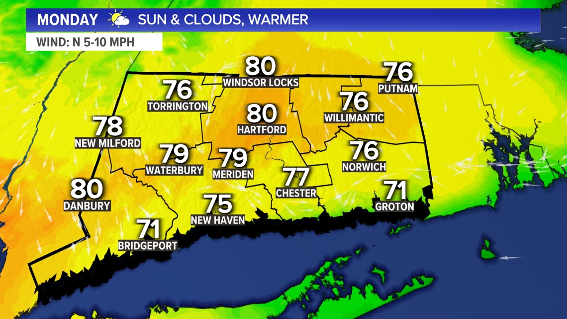
The warmest the Hartford area has been so far this year is 77 degrees on April 15. The average first 80 degree day is April 23, so if we do hit 80 degrees on Monday, it'll be a bit later than average.
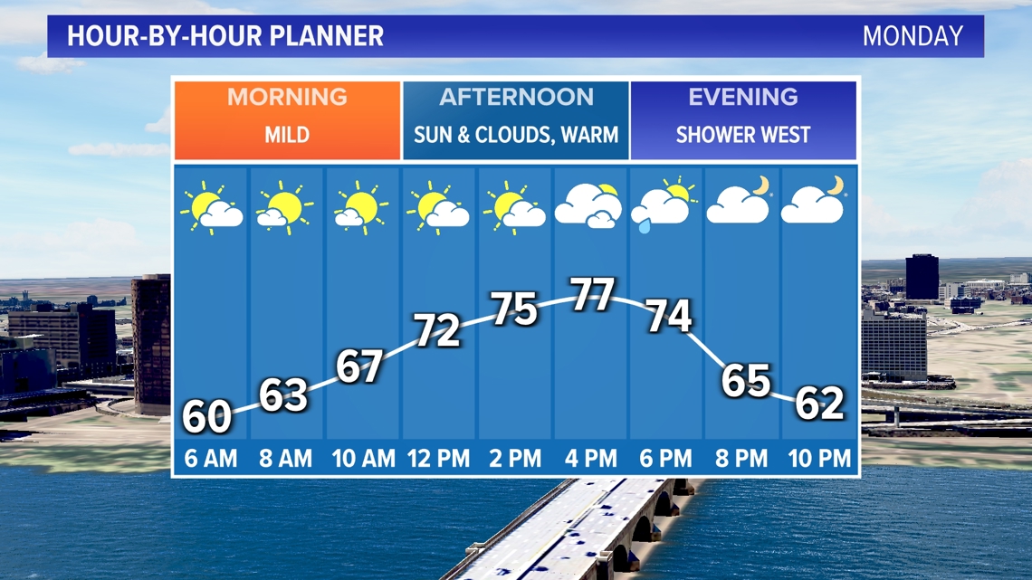
We'll have a mix of sunshine and clouds through the day. It'll be a mild start and a warm afternoon.

As is typical this time of the year, areas within about 10 miles of the shoreline will be cooler.

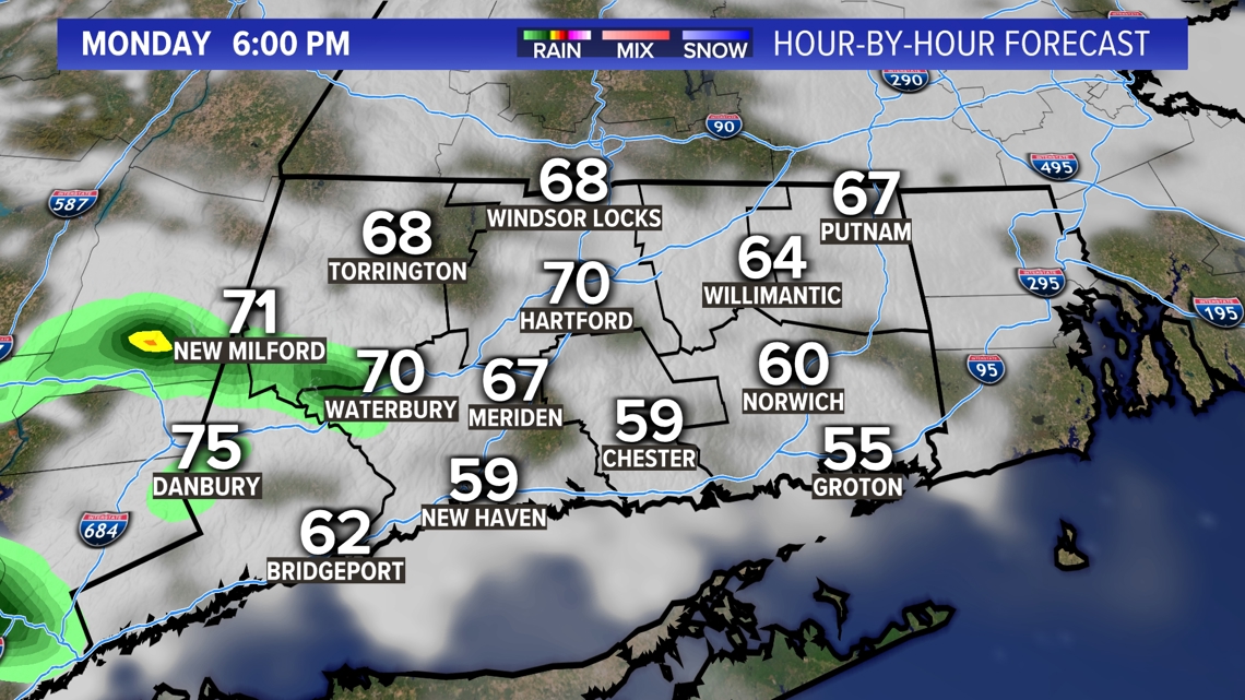
There could be a shower late in the day in western Connecticut.

Tuesday and Wednesday, the warmer air will be pushed to our south. We'll be on the cooler side of the front, but close to average for this time of year.
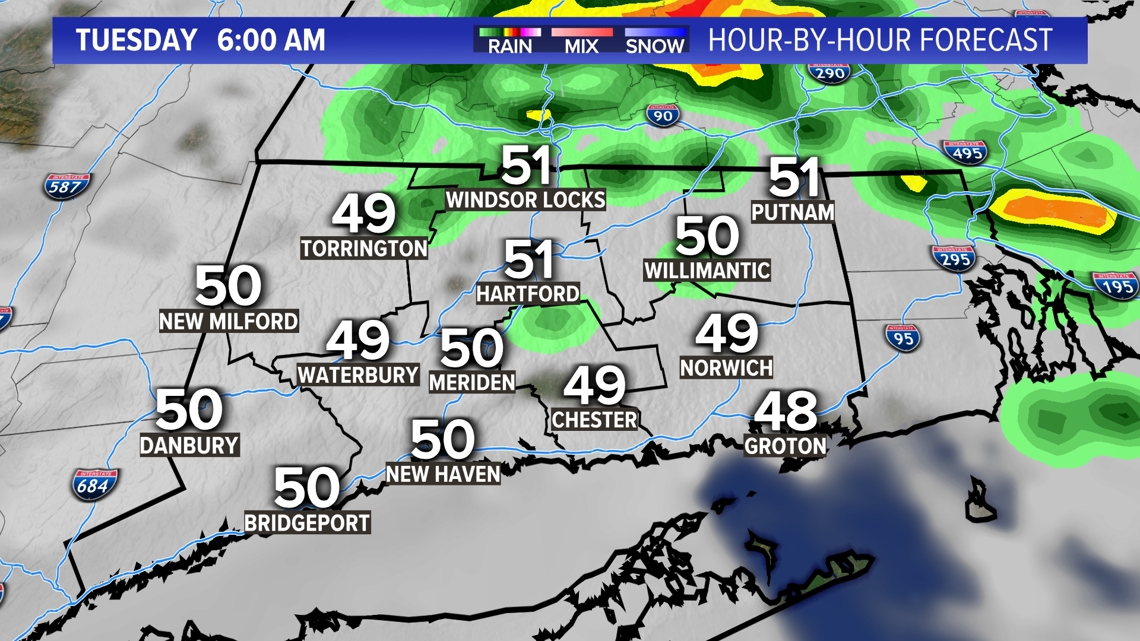
There are two chances for showers Tuesday, one early in the day during the morning.

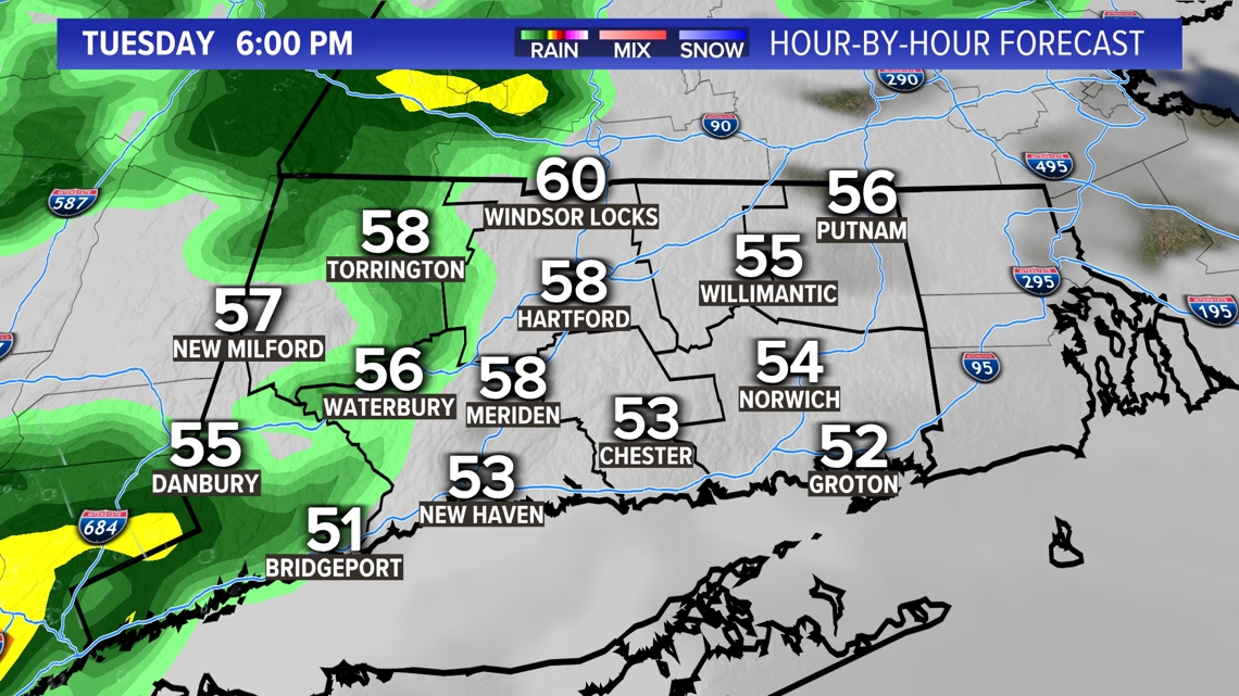
The middle of the day will be mostly cloudy with temperatures mainly in the 60s. Another chance for a shower and possibly a thunderstorm to the west comes Tuesday late afternoon or evening.

A few showers linger Wednesday, along with a lot of clouds.
Thursday and Friday look brighter and warmer.


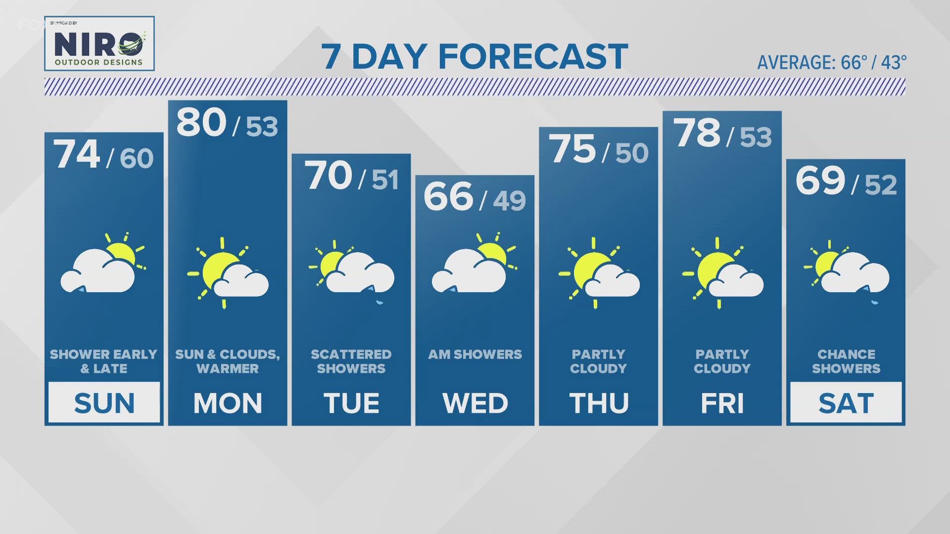
Forecast Details:
TONIGHT: Mostly cloudy with a few showers. Mild and a bit muggy for this time of year. Low: 55-60.
MONDAY: A mix of sunshine and clouds. Warmer. High: Around 80 inland, 70-75 shore.
TUESDAY: Mostly cloudy. Chance for a shower early in the day and late in the day. High: 60s.
WEDNESDAY: Mostly cloudy with a few lingering showers. High: Low to mid 60s.
THURSDAY: Partly cloudy. High: Upper 60s shore, low 70s inland.
FRIDAY: Partly cloudy. High: Upper 60s shore, low 70s inland.
SATURDAY: Mostly cloudy. High: Mid to upper 60s.
SUNDAY: Mostly cloudy. High: Mid to upper 60s.
Follow the FOX61 Weather Watch team on Facebook:
And on X (formerly known as Twitter):
Rachel Frank, Matt Scott, Sam Sampieri, Rachel Piscitelli, Ryan Breton
Watch More: Weather Watch